
We all have a dream that we always wanted to accomplish but never seem to do because of certain reasons and for me that would be hiking Mount Pulag.
Standing at a staggering 2,926 meters above sea level in the intersections of Benguet, Ifugao and Nueva Vizcaya provinces, Pulag is the highest peak in the island of Luzon and the third highest mountain in the Philippines that initially made me doubt if I can conquer this mountain myself. Add up the fact that it is known for its chilly weather and temperature that can drop below 0°C which is a stark contrast against the humid and tropical climate I’ve grown used to.
But with the images of sea of clouds taken from the top of its summit seamlessly floating on the internet, I can’t stop myself from wondering if I can also see the same thing and accomplish such feat until I found myself booking a joiner tour that will climb Mount Pulag on a long weekend. Fast forward to two weeks later, I was catching my breath and smiling after hours of hiking as I finally reach the summit that I’ve always dreamed of.
Table of Contents
- Mount Pulag Fast Facts
- Where to Book Mount Pulag Tours
- Things to Bring in Mount Pulag Hike
- Mount Pulag Hike Itinerary
- DENR Orientation at Bokod, Benguet
- Staying at Kabayan, Benguet
- Hiking Camp 1 and 2
- Reaching Mt. Pulag Summit
- Grassland and Mossy Forest
- Habal-Habal Back to Homestay
- Tips for Climbing Mt. Pulag
- Final Thoughts
Mount Pulag Fast Facts

- Elevation: 2,926 MASL
- Difficulty : 3/9
- Jump-off Point: Kabayan, Benguet
- Major Trails: Ambangeg (Beginner Trail), Akiki (Killer Trail), Tawangan and Ambaguio
- Hours to reach summit (via Ambangeg Trail): 4 hours
- Features: Rolling grasslands, dwarf bamboo slopes, mossy and pine forests, sea of clouds, camping grounds
Where to Book Mount Pulag Tours
My realization that I wanted to climb Mount Pulag was a bit spontaneous since I didn’t plan it initially. After feeling that I was physically and psychologically ready after years of delaying, I committed myself that I’ll be hiking this mountain before the year ends, hence, joining a group tour was the solution for me.
But for those who want to do a DIY climb, hiking Mount Pulag is also possible but expect that this may require more effort and planning on your side and—most of the time—more expensive compared to joining tours.
There are a lot of organizers online, especially on Facebook that arrange climbs to Mount Pulag. To narrow it down, here are two of the options that I had when I was deciding which one to book:
- TakeFive Outdoors – A popular tour organizer on Facebook among hiking enthusiasts and has an app for booking and reservation of slots. They offer packages both for the Ambangeg and Akiki trails starting at ₱4,299 and ₱5,299 respectively.
- Greg Galicia – I first found out about Sir Greg’s services in a blog post of another hiker and travel blogger and found his ₱4,200* all-in package for the Ambangeg Trail a great deal since it includes all the things that I will be needing in the climb including homestay, food, transportation, guides, fees and certificates. Aside from Ambangeg, he also offers a package deal for those who want to take the Akiki trail for ₱4,500*. Apparently, his Ambangeg Backtrail package is also the same one that I availed for my climb.
*Price haven’t been updated recently. I highly suggest contacting organizer for the latest price rates.
Things to Bring in Mount Pulag Hike
Prior to booking my reservation for the climb, I was already busy preparing the things that I’ll be needing for the hike. Knowing that I don’t have the right gear yet to endure Pulag’s trail and nasty cold temperature, I ensured to allot ample time to gather the things I’ll bring.
Based from experience, here is the list of things to pack when hiking Mount Pulag via the Ambangeg Trail:
- Reliable and comfy pair of hiking shoes
- Windbreaker or raincoat
- Down jacket
- Gloves
- Hiking pants
- Thermal underwear
- Set of top and bottom to layer with thermal underwear
- Small waterproof backpack to carry during the hike
- Electrolyte drink i.e. Gatorade
- Drinking water
- Trail food i.e. trail mix, nuts, jellyace, chocolates
- Headlamp
- Cap or beanie
- First aid kit
- Medical certificate (if not included in tour package)
As a person who usually feels cold easily, I can say that the three layers that I prepared for the climb is just enough to beat Pulag’s cold temperature. However, when it’s raining and windy at the top of the summit, this may feel insufficient so better to bring additional layers if you think you cannot endure this.
Medical certificate is also required upon registering and before the orientation at DENR as proof that one is fit to climb the mountain. However, since this is already included in the package that I’ve availed, it was automatically taken care of by our tour coordinator. Nonetheless, there are also clinics located below the DENR Visitor Center for those who will be needing this. You can also bring your own copy if you have before traveling to Benguet.
Mount Pulag Hike Itinerary
Due to the length of time that it needs to reach Mount Pulag’s summit, most tours start their ascend at around 1 or 2AM in the morning to make it on time for the sunrise viewing. Hence, unlike with other day trip hikes, climbing Mount Pulag requires at least two days of travel that includes the transport from Manila to Benguet and vice versa and rest before the hike.
For our climb, this is the sample itinerary that our group has followed:
DENR Orientation at Bokod, Benguet
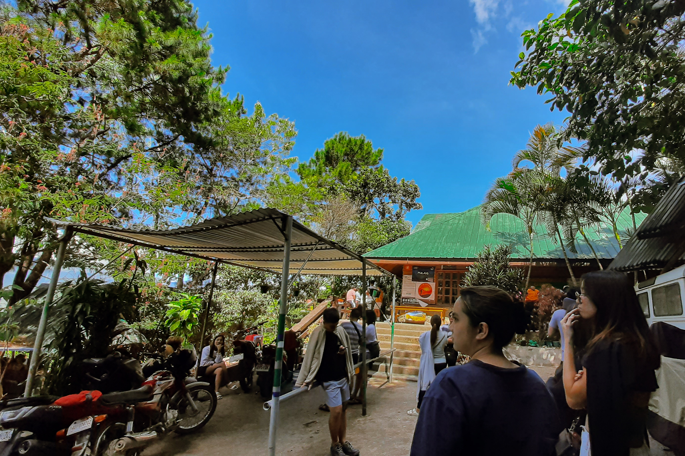
After eight hours of travel from Manila and winding through the busy roads of Baguio City, we have finally reached the first part of our climb which was registering and attending the Mount Pulag orientation at the DENR Visitor Center in Bokod, Benguet.
Surprisingly, I found our journey to the place enjoyable as the views along the way offer a glimpse of Pulag’s famous sea of clouds enveloping the nearby mountain range and Ambuklao Lake providing a relieving sight of body of water in the area.

Upon arriving in Bokod, we were welcomed by a peaceful and quiet Benguet State University located near the DENR Visitor Center where we stayed, rested and waited for our turn for the orientation while enjoying the fresh air, lush greenery and mountain range looming over the background.

At around 12:30PM, our batch was finally called for the orientation where we were informed about the things that we can and couldn’t do while hiking Mount Pulag. There was also a video presentation showcasing general information about the mountain including the different flora and fauna and endemic ones that can be found in its grounds.

Staying at Kabayan, Benguet
Just when I thought that our rough journey has ended upon reaching Bokod, the drive going to our homestay in Kabayan made me hold on to my seat tighter as the road started to get narrower and steeper. Along the way, the bottom of the mountains became farther and smaller while the top became clearer and nearer, and when we finally reached our destination, we were welcomed by a small community of houses perched on steep slopes and other fellow hikers who arrived earlier than us.

As expected, phone reception in the area is very weak or sometimes none at all, that’s why the spot of the so-called “Piso Wi-Fi” or one peso per use of wi-fi is popular among hikers looking to quickly update loved ones. However, do note that when there are a lot of people connected, this can also become slow too.

During our time in our homestay, we just took the opportunity to catch some sleep and get energized by the homecooked meals prepared by our tour coordinator. Fortunately, our accommodation has warm shower too that made it easier for us to freshen up and spared us from using the place’s freezing tap water. By nighttime, everyone was already asleep as we get ready for the start of our climb early in the morning.

Hiking Camp 1 and 2
Mount Pulag’s Ambangeg Trail is divided into three major landmarks namely: Camp 1, Camp 2 and the summit.
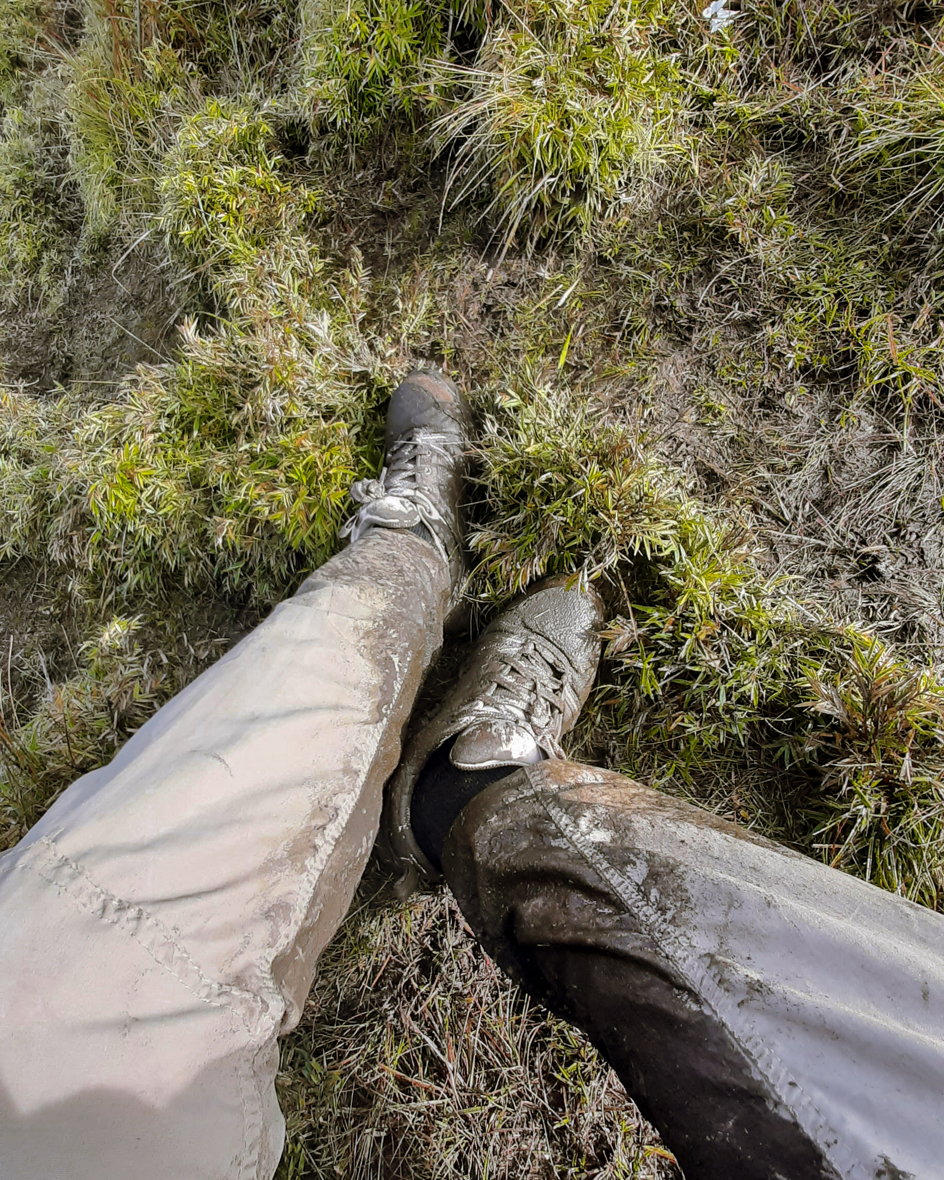
Prior to reaching Camp 1, we started our ascend from Babalak Ranger Station where we were welcomed by a steep paved road going to the start of the trail. Since it was dark and early in the morning, we weren’t able to see much sight during this part of the hike except for the moon and a few visible stars in the sky. The trail has also become muddy due to the previous night’s rain that made our pace slower.
The path going to Camp 1 isn’t necessarily difficult except for the steep inclination near the camping ground. However, I still experienced a few challenges along the way brought by the cold weather and thinning oxygen level as we go higher and higher.
Our hike going to Camp 2 is probably the longest and most diffucult part of the climb for me due to the large area of Mossy Forest leading to it and the rocky and steeper assaults of the path. With thinning oxygen levels partnered with drizzle and cold weather, the ascend became a bit difficult that I personally had to rest along the way and catch my breath. The trail also became muddier that further made our pace slower and even caused us to get separated from our group for a short time.
When we reached Camp 2, we were welcomed by the marker sign signaling that we have reached our second destination. This place is also the spot for female hikers to take a pee since there are two latrines available at the other side of the camping ground. There is also a fresh water source a few meters before reaching Camp 2 where thirsty hikers can refill their bottles.


Reaching Mt. Pulag Summit
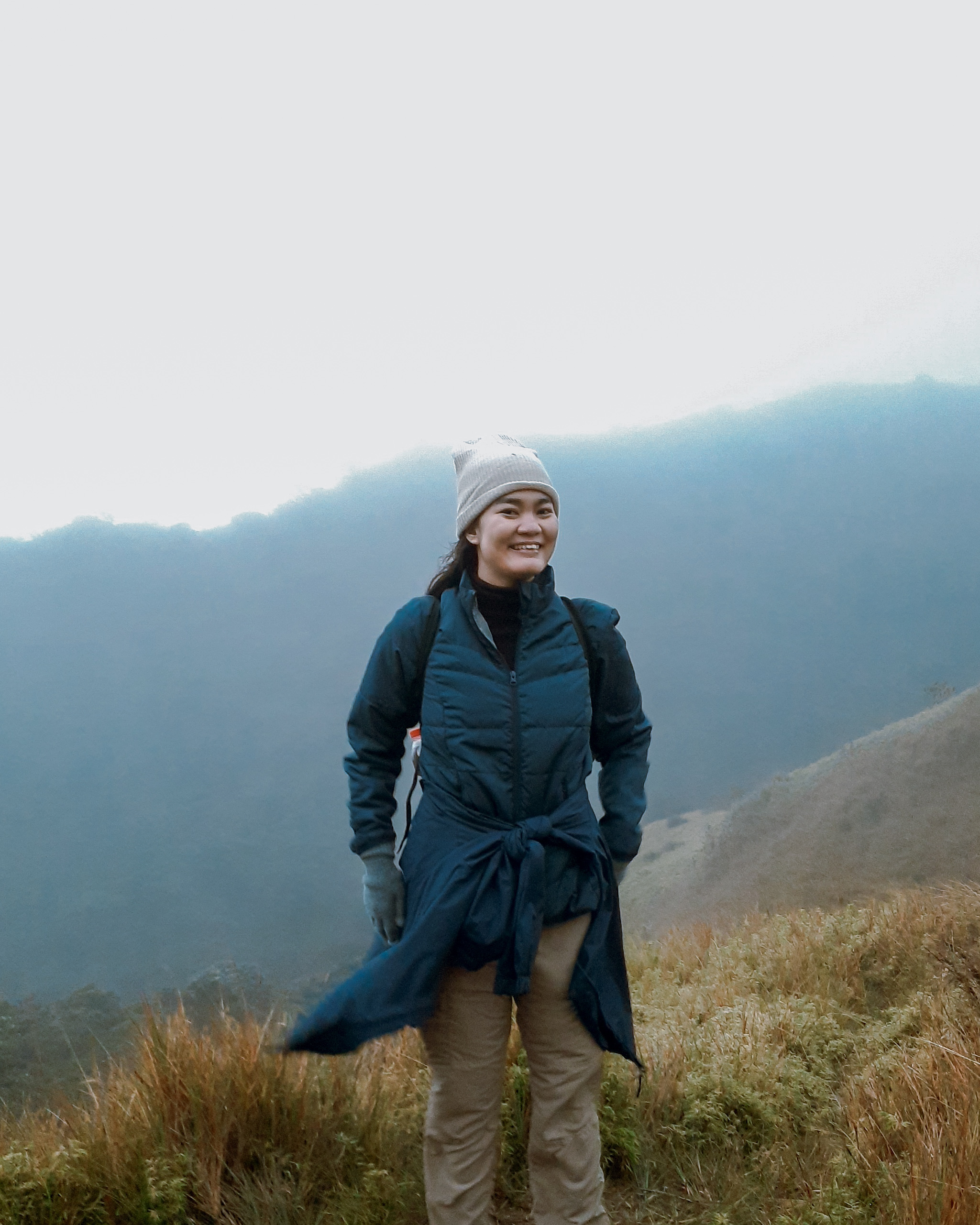
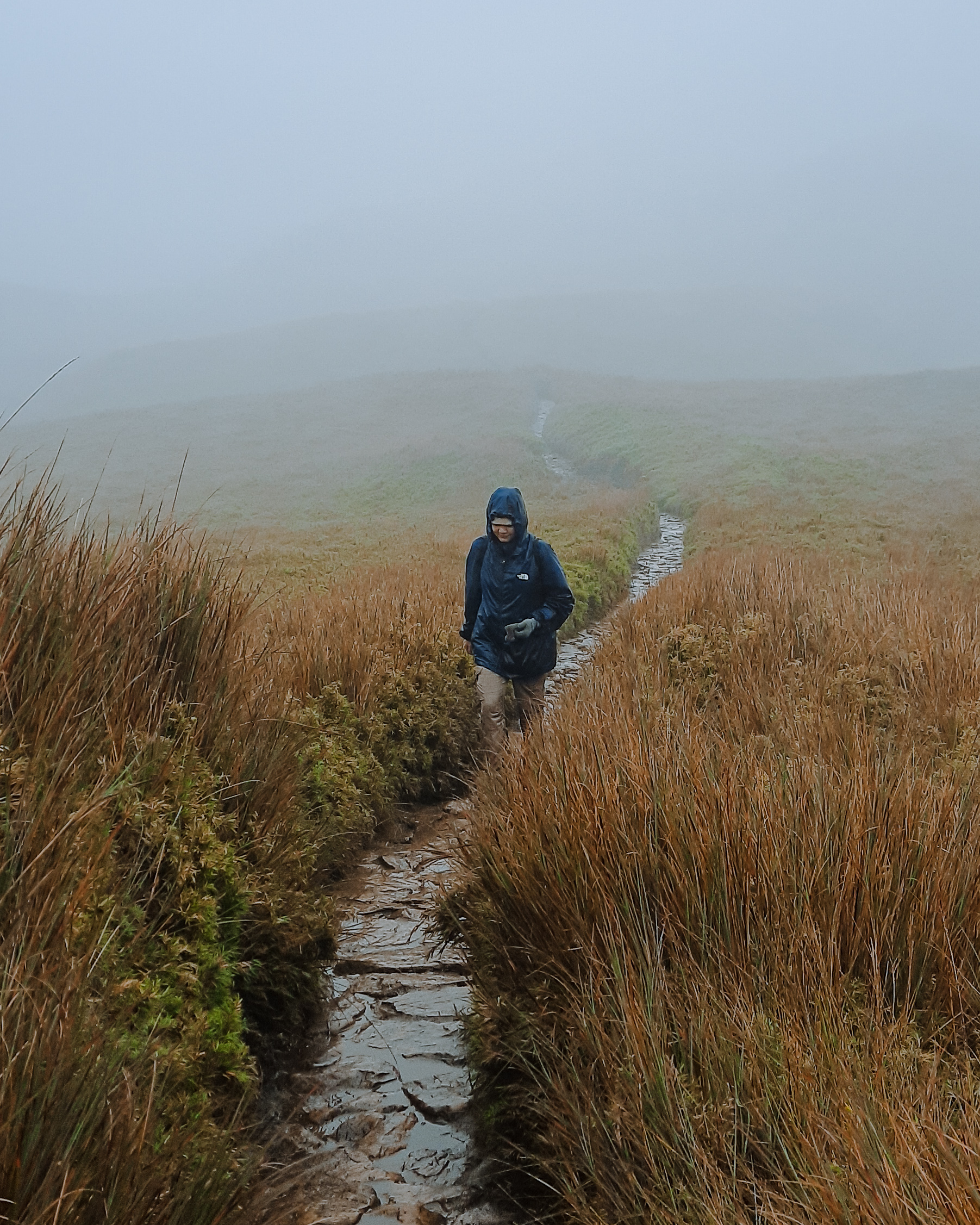
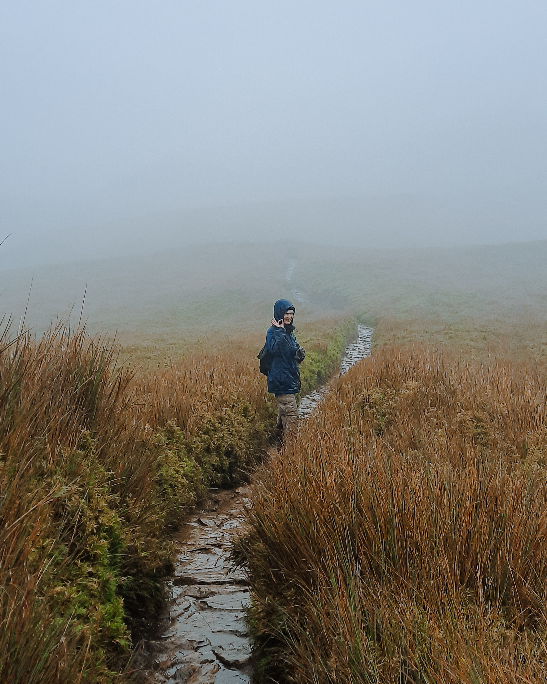
After a pitstop and a few snaps at Camp 2, we continued our hike to the so-called ‘grassland’ area of the mountain where the previous mossy trees were replaced with tall grasses bordering the rugged path.

The sight of the crack of dawn also made us realize that we were behind our scheduled arrival at the summit and would unfortunately miss the anticipated sunrise viewing. Circumstances has also become more difficult when it started raining while we’re hiking this part of the mountain that made the remaining parts of the trail completely muddy. The only silver lining during this part of our climb is the absence of major steep inclinations due to the trail being generally flat.


After two hours of getting drenched in the grassland’s rugged trail, we have finally caught a glimpse of Mount Pulag’s summit looming in front of us. However, despite this sign of hope, the trail has become difficult again with the reappearance of steep inclinations that extended up to the last assault going to the summit. Honestly, this was the part of the climb when I started asking myself if I can still go on because of tiredness. But with the motivation of other hikers who were now on their way back to the campsite, we kept on pushing through until we were taking those final steps away from the summit marker.
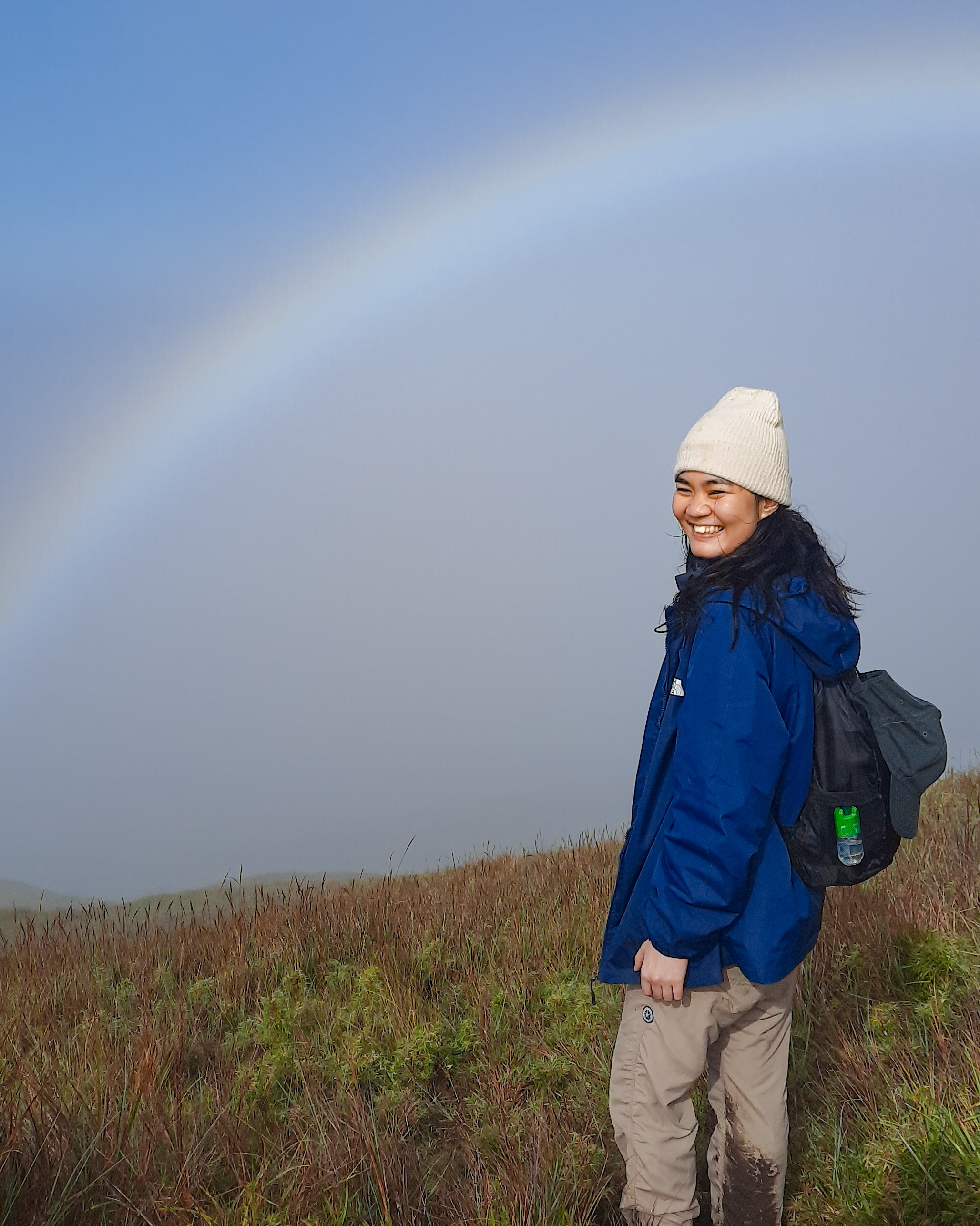
Despite being welcomed by a swarm of hikers wanting to take photo ops, I found myself smiling upon setting afoot at the summit and finally seeing the famous Mount Pulag marker in real life. Although there wasn’t any clearing upon our arrival that prevented us from witnessing the iconic sea of clouds, we were greeted by a rainbow at one side of the summit that seemed to be welcoming and congratulating us for reaching the top. The other sides of the area offer vantage points of the lower peaks and the trail that we have taken below that completed the 360-degree view.


Grassland and Mossy Forest
After an hour of resting, lining up for photo ops and dealing with the strong winds and rain at the summit, we retraced our steps back down the trail where we had the chance to better appreciate Pulag’s landscape and biodiversity under the daylight.
After surpassing the steep and narrow parts of the trail, we found ourselves back at the grassland area which provided us with a picturesque misty scenery of rolling grassland that seems to depict an English countryside. Not long after this, we were welcomed once again by—this time—an empty Camp 2 where we briefly rested before entering back again to the Mossy Forest.

Unlike before where all we saw were darkness and a few plants illuminated by our headlamps, Mossy Forest under the daylight seems to transport you to a distant enchanted woodland that you usually see in fantasy movies with its trees’ branches covered with thick moss swirling on top of you as a canopy. The place is also filled with different kinds of plants mostly dominated with fern plants that usually border the trail.


I am not sure if it’s because of tiredness, hunger or lack of sleep but while hiking through the forest, I had several experiences of seeing forms of humans and animals in my peripheral vision only to find out that it is just a tree trunk or a plant at the side of the trail. Our tour coordinator has also warned us that people who have third eye or those who can see paranormal things have said that they have seen unexplainable entities in the area which also seems to support the claims of the locals that the forest indeed enchanted. Nonetheless, aside from this, nothing unusual has happened during the remaining parts of our descend up until we reached Camp 1.
Habal-Habal Back to Homestay
After a grueling descend from Camp 1 going to the start of Ambangeg Trail, we finally ended our 12-hour hike of Mount Pulag by riding a habal-habal (motorcycle back ride) back to our homestay. For ₱200, tired hikers can avail of a ride going back to their accomodation with the handful of drivers waiting at the beginning of the trail. Those who still have the energy have an option to continue and finish the hike back to Babalak Ranger Station.

Apparently, we decided to take a habal-habal since we were all tired and exhausted from the long hours of walking. Yet despite this acceptance of defeat, we were still treated with a wonderful experience as the views of terraced mountains along the way which we didn’t get to see in the dark earlier are sights to behold; probably the best habal-habal experience I had so far and a beautiful way to cap off our climb.

Tips for Climbing Mt. Pulag
Despite my preparations and having experienced climbing several mountains prior to Mount Pulag, hiking it still became a challenge for me even when I took its beginner-friendly Ambangeg Trail. It is important to note that it is one of the highest peaks in the country, hence, one should not underestimate its trails and the experience it may bring. So here are a few tips (and things I wish I have also known) from yours truly who survived hiking Pulag.
- Don’t fully believe that the Ambangeg Trail is truly beginner-friendly. If you’re expecting that this path would be a walk in the park as what others have claimed, don’t, especially if you’re not a regular hiker. Personally, my climb to Mount Pulag is one of the most challenging ones I’ve experienced and a mountain that I can consider is a major hike.
- Bring a hiking pole if you have or if you can. For seasoned climbers this may be an accessory that wouldn’t be necessary for climbing Pulag, but for casual hikers, it would be very helpful especially when you’re dealing with steep inclinations or muddy trails.
- Waterproof everything. This includes from the gear you’re going to wear up to the backpack where you’ll be storing your trail food. Tour organizers usually remind this to climbers since the weather in Pulag is unpredictable and I can attest that this is an important thing to take note of.
- Don’t bring too much drinking water. This may sound contradictory given the nature of hiking as an activity but it would spare you from carrying too much weight on your back during the long hike. Based on our experience, we weren’t able to consume the 1.5-2L water we have prepared and was only able to drink around 750ml of water throughout the entire hike. This is also because the weather is too cold that you wouldn’t feel the need to drink. I suggest to bring an electrolyte drink like Gatorade as I personally felt recharged after minutes of taking it during the trek.
- Avoid the weekends and climb on a weekday. If you want to avoid the crowd and have the summit all by yourself or with a few others, it is highly recommended to climb on a weekday. This would also allow you to manage your pace on your own and not depend on the speed of other hikers ahead of you.
Final Thoughts
Despite the grueling experience I had of climbing Mount Pulag for the first time, I still want to come back and hike this mountain one more time to appreciate it more and experience the sunrise at its summit and get a glimpse of its famous sea of clouds. I finally now know why others have been returning to this mountain for several times as it indeed provides the outdoor adventure that one is seeking. My return can be in a few months or in a few years but either way, hiking Mount Pulag is surely an experience that is one for the books and a dream fulfilled for any local hiking enthusiast.
Ready to hike Pulag or have experienced climbing it already? Share your thoughts and other experiences in the comments below!
If you also find this post useful, you can support me in creating more travel and hiking guides in the future! Just tap on my Ko-fi or Buy Me a Coffee profile to get started or share this post with your friends or socials for free!
Read more hiking posts!


Leave a reply to Discovering Maligcong’s Gems: Hiking Mt. Kupapey, Mt. Fato and Maligcong Rice Terraces – Graphic Wanderlust Cancel reply