
With an upcoming overseas trip to a nearby country known for its bay filled with towering limestone karst cliffs and rice terraces (that’s the clue! 😉), I suddenly had the urge to visit the latter locally to compare the possible differences during my trip and finally fulfill my desire to see and experience the Cordillera region beyond the province of Benguet.
Known for its unique culture, lush vegetation, higher elevation, and remarkably chilly temperatures compared to the rest of the country, the region of Cordillera has been on my radar for a while now, particularly the UNESCO World Heritage Site of Batad Rice Terraces and, of course, the famous Banaue Rice Terraces, both in the province of Ifugao.
Conquering my anxiety and uncertainty about the safety of the roads leading to the region, I finally decided to book and join a hiking tour to it with a main stop in Maligcong, Bontoc, Mountain Province to climb and see the trending Mount Fato, Mount Kupapey and Maligcong Rice Terraces and side trips to the nearby Banaue Rice Terraces and the town of Sagada.
Read on to find out more about these Cordillera treasures and how we managed to fix an itinerary covering all of it within a span of over the weekend.
Table of Contents
- Mt. Kupapey & Mt. Fato Fast Facts and Location
- Maligcong Weather
- Mt. Kupapey x Mt. Fato Join-in Tour
- 2D3N Itinerary
- Things to Bring
- Driving Up North to Banaue Rice Terraces
- Arrival in Maligcong
- Afternoon Climb at Mt. Fato
- Early Morning Hike to Mt. Kupapey
- Traverse to Maligcong Rice Terraces
- Side Trip to Sagada and Halsema Highest Point
- Tips for Hiking Mt. Kupapey and Mt. Fato
Mt. Kupapey & Mt. Fato Fast Facts and Location
Mt. Kupapey
- Elevation: 1,647 MASL
- Difficulty: 3/9
- Jump-off Point: Maligcong, Bontoc, Mountain Province
- Hours to reach summit: 1.5-2 hours
- Features: Overlooking view of Maligcong Rice Terraces, sea of clouds, pine tree forest
Mt. Fato
- Elevation: 1,438 MASL
- Difficulty: 3/9
- Jump-off Point: Maligcong, Bontoc, Mountain Province
- Hours to reach summit: 1-2 hours
- Features: Summit rock formations, pine tree forest, overlooking view of Maligcong
Maligcong Weather
The Cordillera region is known for its colder temperatures than the other parts of the Philippines; hence, Maligcong’s weather is also cooler than that of the lowland areas of Luzon.
During our trip between November and December which is a transitional period from wet to dry season, the average temperature lingered around 22°C during the day and would go as low as 15°C in the night. The weather conditions also varied throughout the entire day with cloudy skies in the morning turning into light rainy gray skies towards the afternoon. Nonetheless, there are also days during these months according to our guide when the weather conditions would be better with clear skies at the latter part of the day offering a chance to catch a sunset.
Layering one to three pieces of clothing is the ideal choice to stay warm and comfortable in Maligcong during this period with the early mornings and evenings being the coldest parts of the day. However, expect to shed a layer if you plan to visit during the summer season as temperatures also rise during this period.
Mt. Kupapey x Mt. Fato Join-in Tour

As a busy city girl with a love for quick weekend nature escapades, opting for hiking join-in tours has become the most convenient option for me to fuel my adventures and to spare myself from the tedious activity of planning the entire trip.
For this hike, I booked TakeFive Outdoors’ Kupapey + Fato + Sagada tour package which includes the round-trip van transfer to Maligcong and Manila, a side trip to Banaue, Sagada and Baguio, overnight homestay accommodation, environmental and guide fees, coordinator, select hosted meals and travel insurance for ₱3,899*. This was further reduced to ₱3,699 after using their voucher code as a first-time app user. Nonetheless, expect to still shell out an approximate amount of ₱1,500 during the trip as most meals and other non-related expenses are not included in the package.
*As of July 2025, the package price has increased to ₱4,049.
2D3N Itinerary
For our two-day and three-nights excursion, here is the actual itinerary we followed in visiting the different Cordillera destinations in our itinerary:
Things to Bring
Due to its relatively easier trail, shorter time to reach its summits and milder temperature, the things I prepared for the climb to Mt. Kupapey and Mt. Fato are almost similar to other minor hikes I did in the past and are not as extensive as my preparation for Mt. Pulag last year.
The most important ones to bring are a reliable warm jacket to beat the chilly temperature in the early mornings and evenings and a sturdy hiking pole to assist you in the steep ascents in some parts of both mountains’ trails.
For the list of other essentials to pack, here is an enumerated checklist of the other things to bring when hiking Mt. Kupapey and Mt. Fato:
- Comfortable hiking shoes
- Hiking pants/shorts/leggings/nylon pants
- Warm jacket
- Windbreaker or raincoat for unexpected rains
- Lightweight t-shirt/base layer
- Headlamp
- Waterproof hiking backpack
- Trail food
- Drinking water
- Hiking pole
Driving Up North to Banaue Rice Terraces
After picking up all the tour joiners in the designated locations, our trip north started past midnight, with the Banaue Arch in Ifugao as the first stop of the itinerary.
Nestled at the heart of the Cordillera mountains, travel time to Banaue from Manila can take up to seven hours which I mostly spent by sleeping inside the van and waking up from time to time due to bumps on the road or pain experienced from sleeping in a curled position. The next thing I knew was our van pulling up at the side of the road with a clear view of the outside signaling that it was already morning and that we had finally reached the famous Banaue Arch.

There’s really not much to see and do in the area aside from photo ops but if you’re interested in buying Ifugao woodcraft and souvenirs or having a quick breakfast or toilet break after hours of traveling, this spot is the best place to do those. But for my case who was still groggy after several hours of uncomfortable sleep, I just waited for my tourmates to return in the van after taking a quick photo op before heading to our next main destination.
One of my realizations, as we approached our next stop, was that there were a handful of vantage points to choose from where one could see the famous Banaue Rice Terraces.
For our visit, our tour coordinator took us to the Dianarra View Deck which provides a 180-degree view of the surrounding terraced mountains and a chance to take a photo op with the local elderly tribe dressed in traditional Ifugao clothing who are sitting at one part of the place. In addition, there’s a nearby souvenir shop and a restaurant catering to visitors where we had our breakfast for the day.


Contrary to what one may expect, seeing the Banaue Rice Terraces for the first time didn’t give me a ‘wow’ feeling probably because of the less-defined features of the mountains when compared to the ones found in the nearby neighborhood of Batad. The place seems like it hasn’t been frequently used for farming in recent years with the presence of lush vegetation surrounding the terraces. Nonetheless, it was still a remarkable moment for me since I was able to tick off another famous local tourist spot which I only used to see in books and photos before.
Arrival in Maligcong
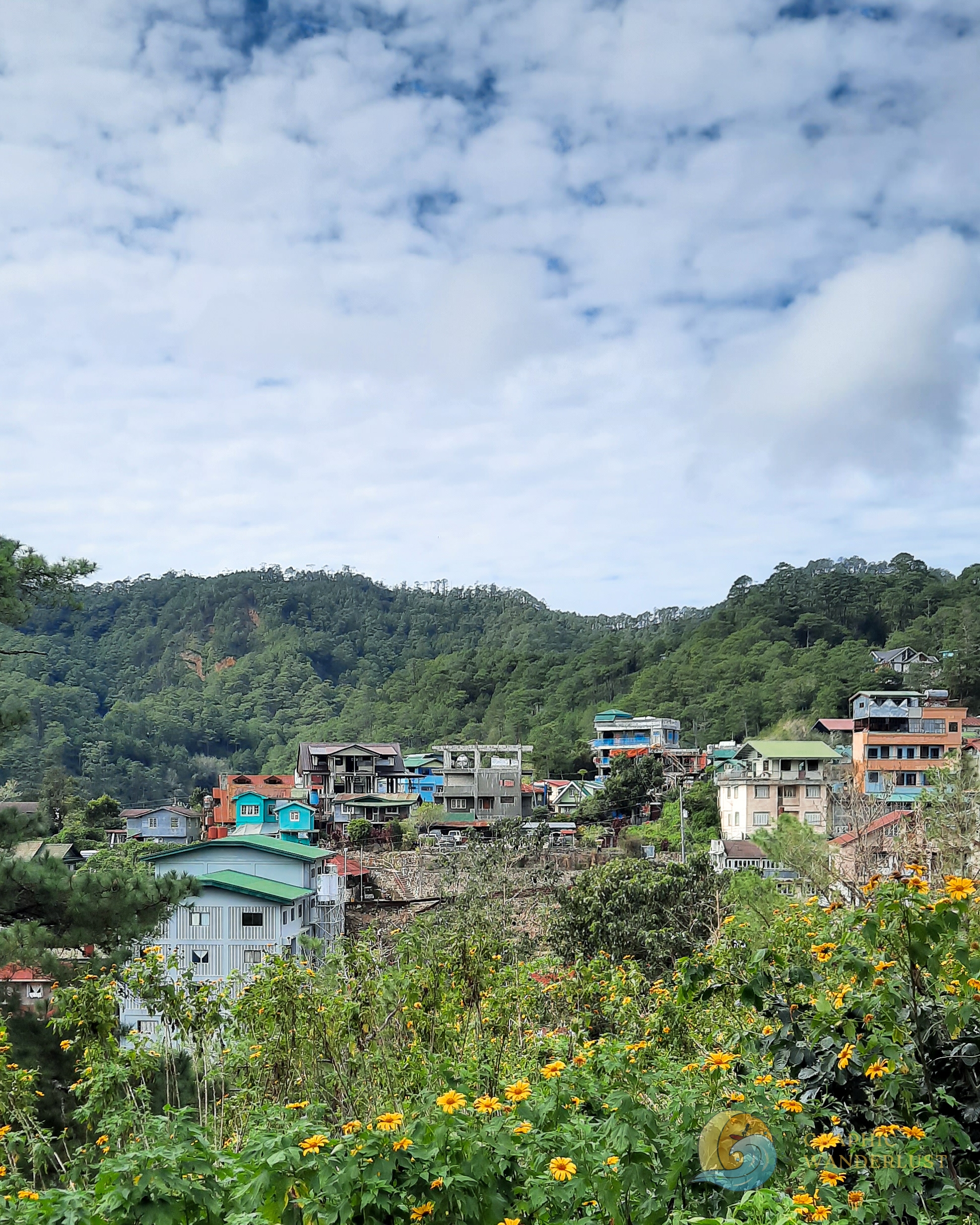
After fueling our bodies with a hearty breakfast and hot brewed coffee, our journey to Mt. Kupapey and Mt. Fato continued as we headed further north in Mountain Province.
The views of more rice terraces and the distinct blue color of the rivers flowing into the valleys found along the way entertained and kept me awake that I didn’t notice that we had finally reached the capital of the province, Bontoc, and were on our last leg of our trip going to our jump-off point in the neighborhood of Maligcong. At around 11:30AM, we finally reached our accommodation at Dong-Elay’s Homestay where we will be staying overnight, capping off our 11-hour travel time.

From our homestay, one wouldn’t have a hard time catching a glimpse of Maligcong Rice Terraces as it sits close to this attraction. Nonetheless, as expected, phone reception and mobile data are very weak in the area which was a bit of a downside but mostly a good thing to disconnect.
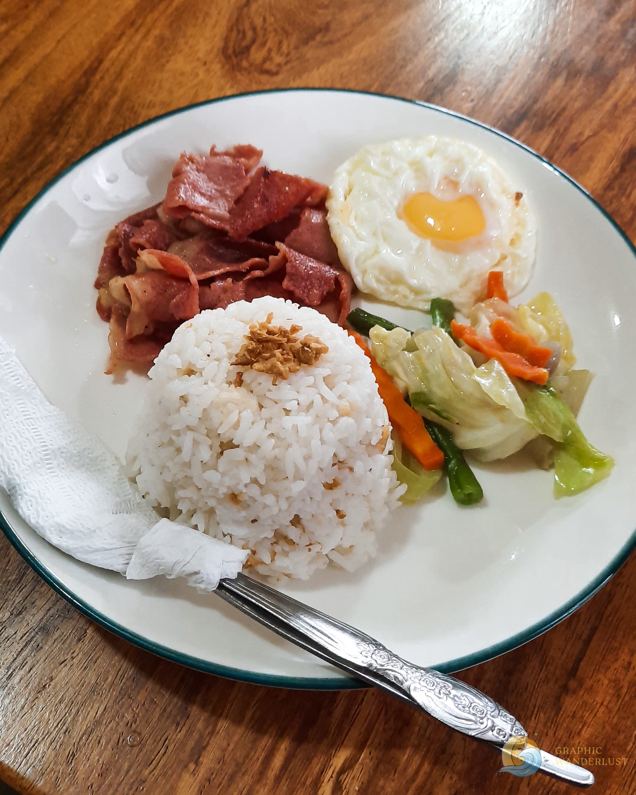
Not long after our arrival, our ordered lunch was also served which we heartily devoured as our tour coordinator announced that we would be climbing Mt. Fato at 3PM later that afternoon.
Afternoon Climb at Mt. Fato
After four hours of resting and settling in, our tour coordinator gathered our group once again for a quick briefing before hiking Mt. Fato where we met our guides who relayed a few reminders before climbing. We also learned from one of them that the mountain was named after the rock found at the top of its summit. Not long after this, our hike commenced at the start of the trail located just a couple of meters away from our homestay.
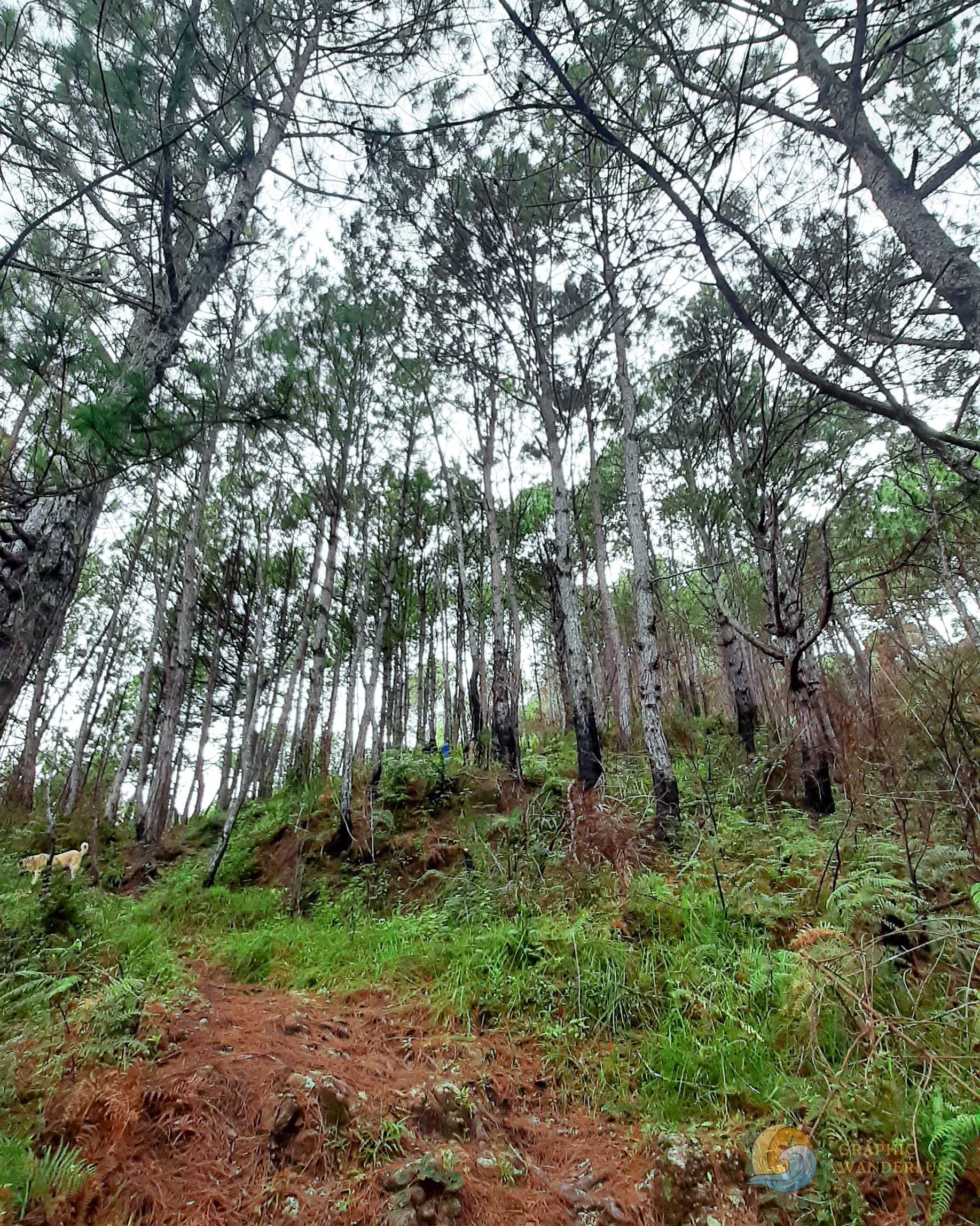
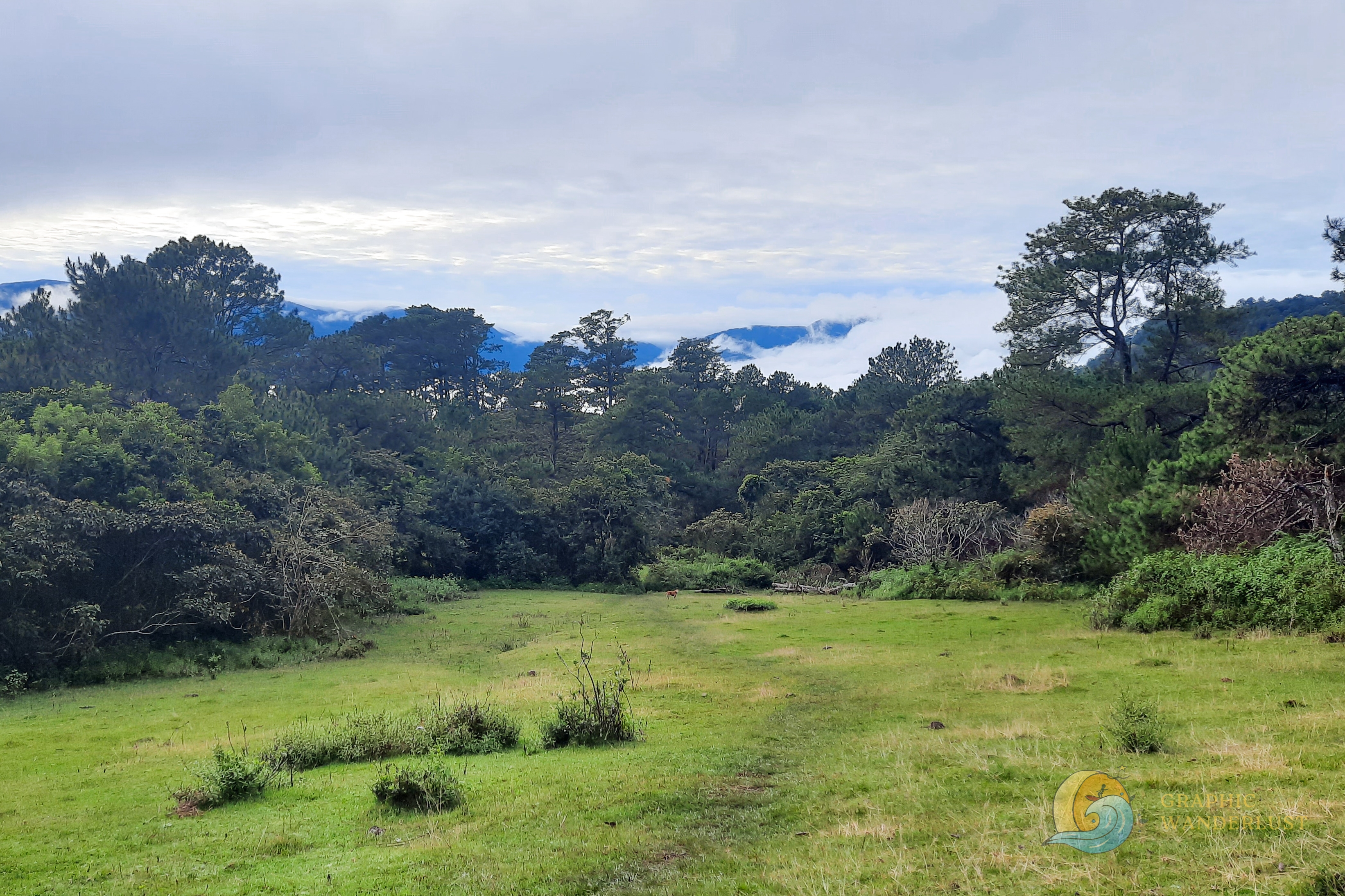
Mt. Fato’s trailhead starts with a steep concrete staircase from the side of the street which opens up to a forest filled with towering pine trees. The trail in this section is slightly rocky and unmarked which may be a bit difficult to follow without a guide leading you. A handful of fallen tree branches and flora also fill and flank the path while a view of the nearby Maligcong Rice Terraces looms over the background of climbers. The trees’ trunks in this area are also noticeably darker than usual which our guide has relayed was an effect of the recent man-made fire that broke out in the forest.


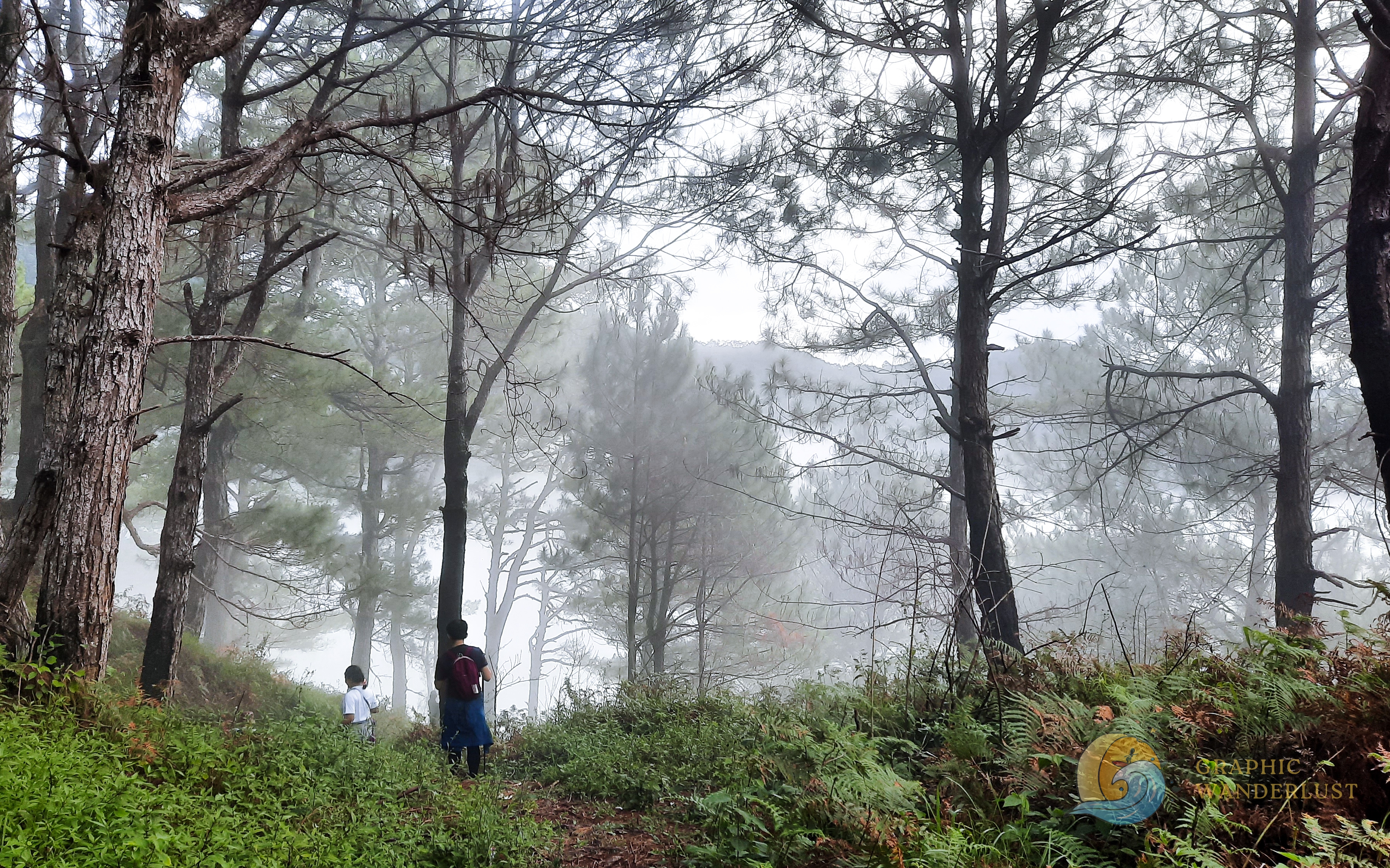
Based on experience, this is the hardest part of hiking Mt. Fato due to the steepness of the trail which continues up until its middle part. Personally, I had to take a break and catch my breath in between to rest my lungs and thighs after nonstop minutes of hiking. But after a few more ascents, we were rewarded with a picturesque cloud cover providing a mist to our surroundings and a flat section of the trailway where more lush pine trees are found.
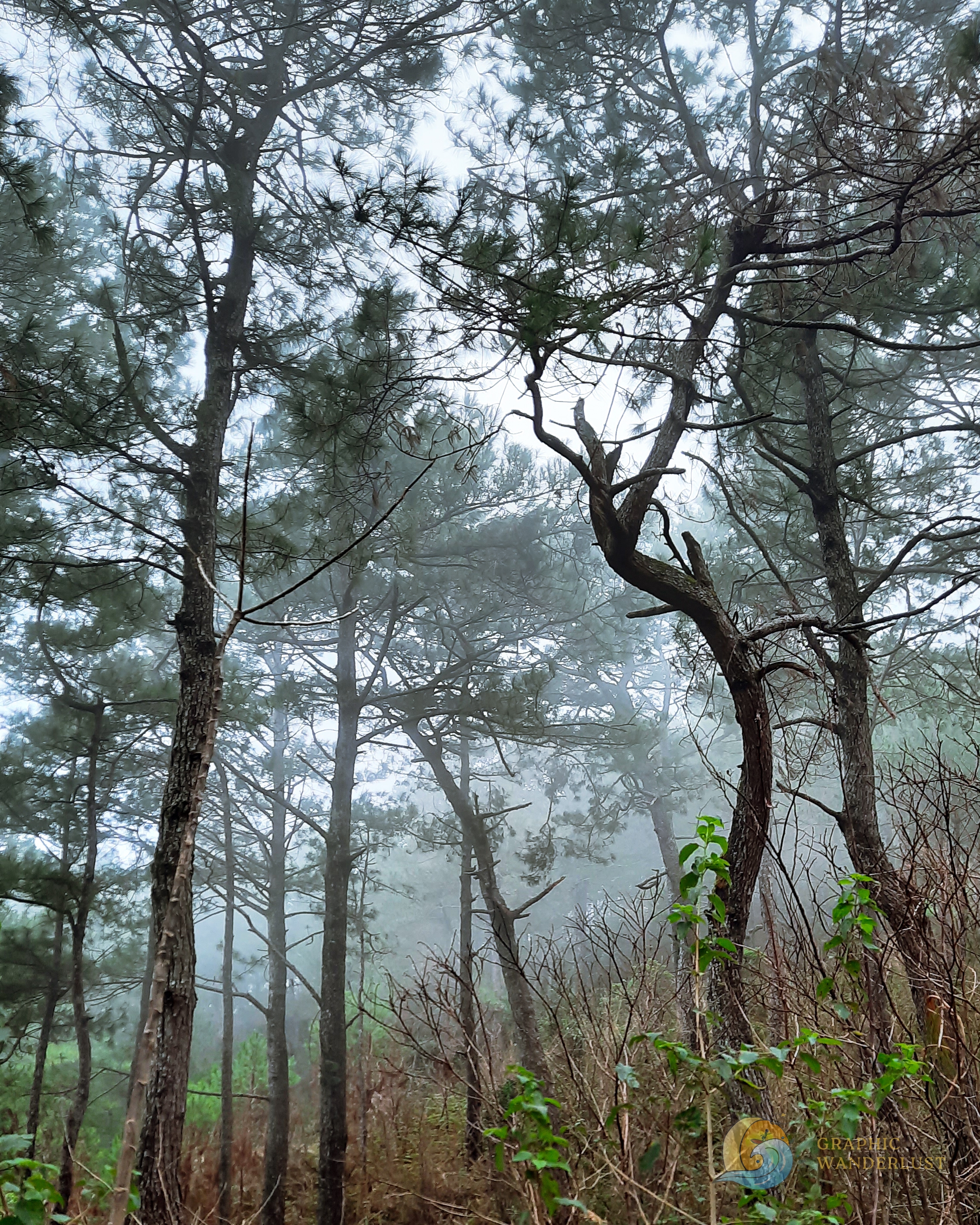
The path in the middle section of Mt. Fato’s trail is mostly flat, well-marked and can be easily followed. I also personally found trail running on its route enjoyable because of the presence of humps on it. During our visit, the view from this section also became scenic due to the thickening mist that surrounded the area.

The last part and ascent of the trail provided a bit of a challenge due to the presence of a boulder which required hikers to do a scramble to pass over it. Once accomplished, climbers are then rewarded with a view of Mt. Fato’s summit where its distinguishing rock formations sit at one part and a mini grassland flanked by pine trees on the other.
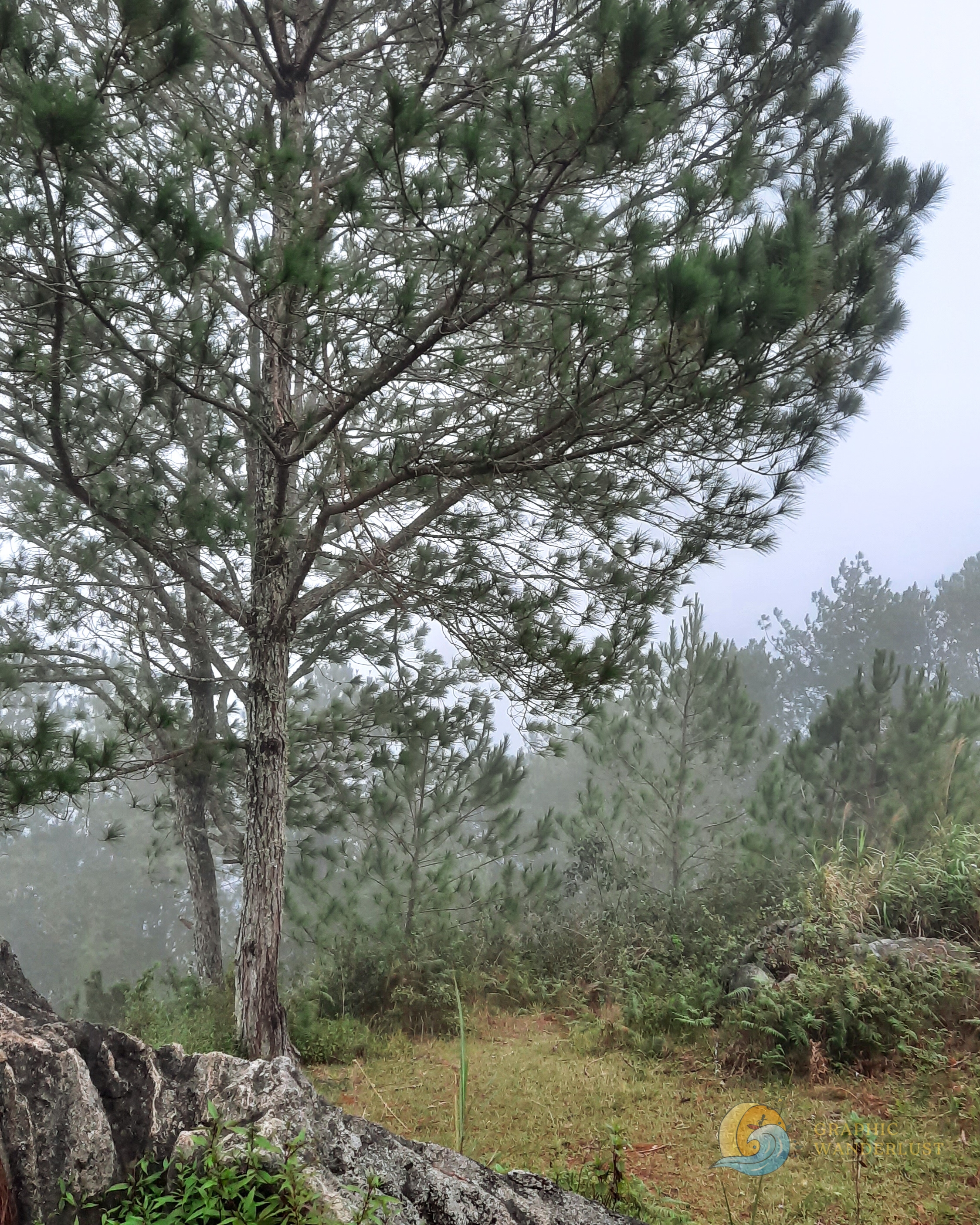
Since the summit was a bit crowded when we arrived and there was a queue taking photo ops with the rock and marker, we spent our first few minutes in the area taking pictures in the mini grassland section. This is also the spot to get shots overlooking Sitio Favuyen and Maligcong Rice Terraces which, unfortunately, we weren’t able to do since there was no clearing during our hike. Nonetheless, the misty view also didn’t disappoint as we were able to get a mystical ambience due to the cloud cover.


After more or less 45 minutes of waiting for our turn to get photo ops at the summit and with the looming rain and darkness gradually enveloping us, we started our descent.
As expected, the activity became difficult with the low visibility, especially for me who forgot to bring my headlamp during the climb. The trail has also become muddy due to the light rains which required further caution. Fortunately, after around an hour of climbing down in the dark, we were able to reach and go back to our homestay safely without any issues.
Early Morning Hike to Mt. Kupapey
After a warm shower, hearty dinner and five-hour sleep from the previous night, our group is up once again the following morning to prepare for our anticipated climb to our main destination, Mt. Kupapey.
Similar to yesterday, we had a quick briefing and reminders before the start of the hike with the same guides as before who shared that the mountain’s name came from the big butterflies that used to be seen in the area. They also advised us that, despite the trail being similar to Mt. Fato, the hike is going to be longer and we will be taking the traverse on the way back to the homestay later. Not long after this, we were back on the street of Maligcong, this time going opposite to the direction of Mt. Fato’s trailhead and, instead, towards the direction of the rice terraces.
The start of Mt. Kupapey’s trail begins at the residential side of the rice terraces with a staircase gradually opening up to the forest which has a steepness similar to that of Mt. Fato’s. Honestly, since it was dark, I wasn’t able to get much sight of our surroundings and focused instead my attention on climbing the trail which started to get difficult with the steeper and slightly muddy assaults that welcomed us.
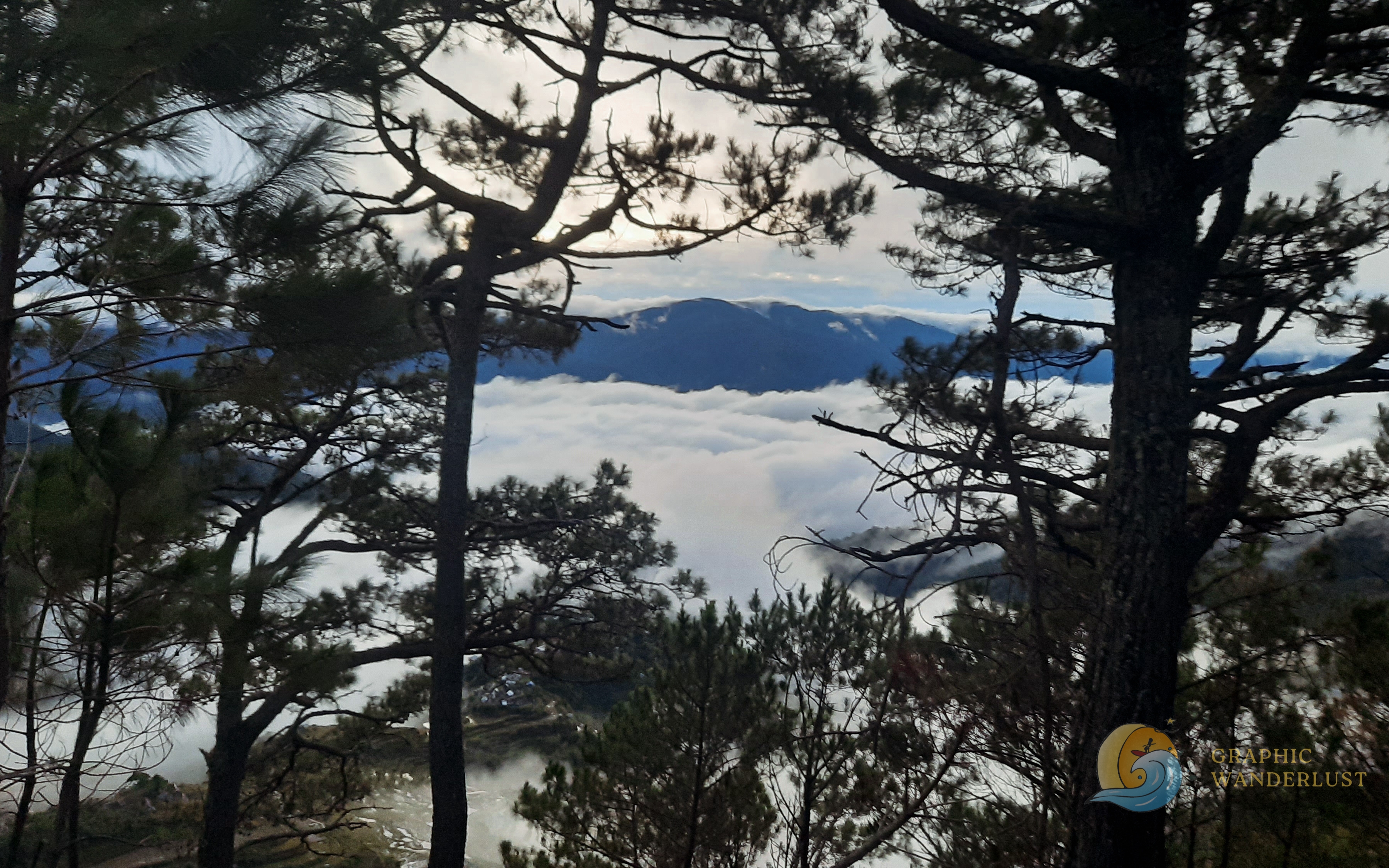
After more or less an hour of hiking in the dark, we finally reached the grassland area of the trail which, contrary to the previous section, was mostly flat and was only elevated towards its edge. Soon afterwards, we made our way to the final assault of the trailway which opened up to the flat path going to the summit and at around 5:30AM, we were able to reach Mt. Kupapey’s highest peak, capping off our 1.5-hour hike and still a few minutes left before sunrise.

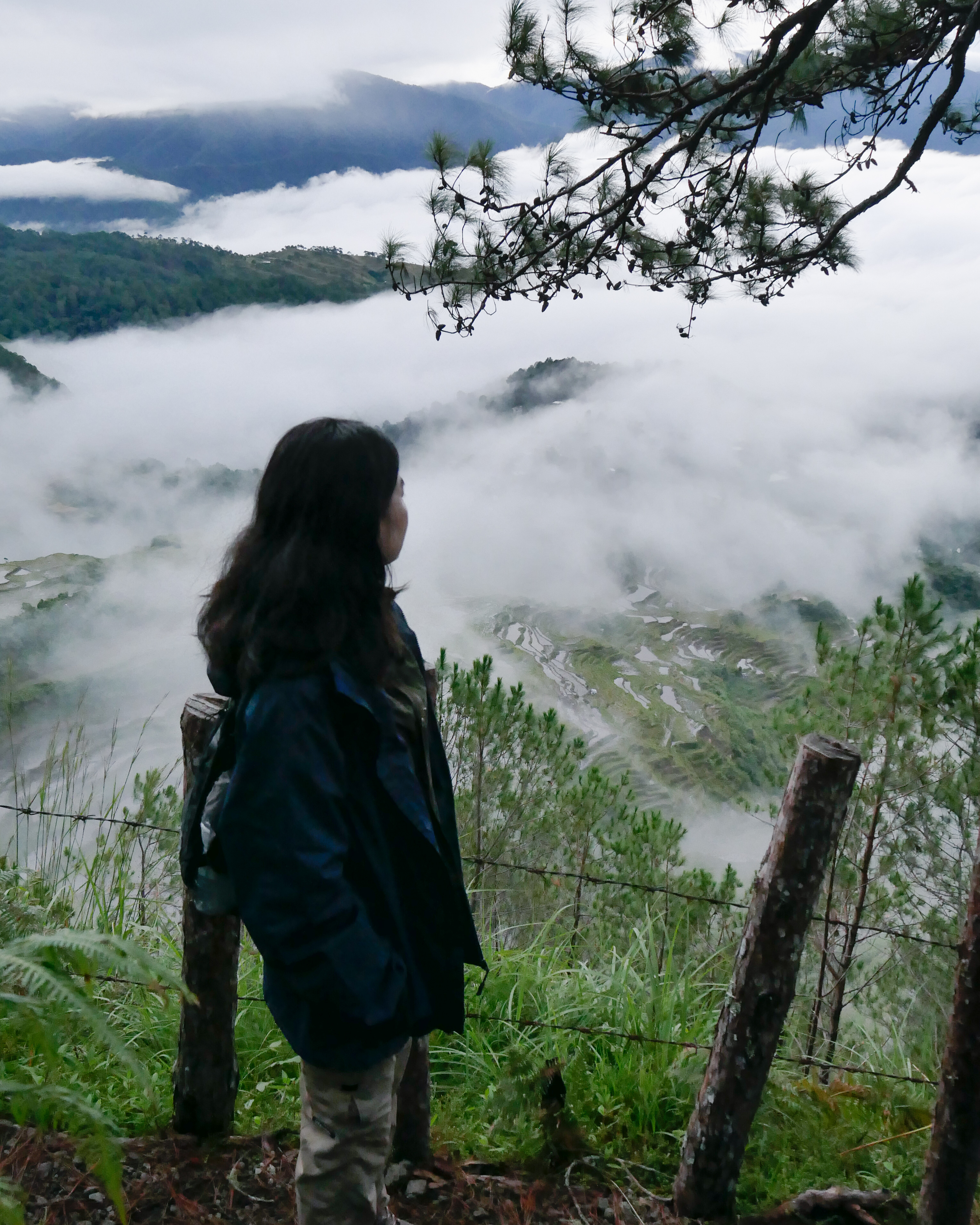
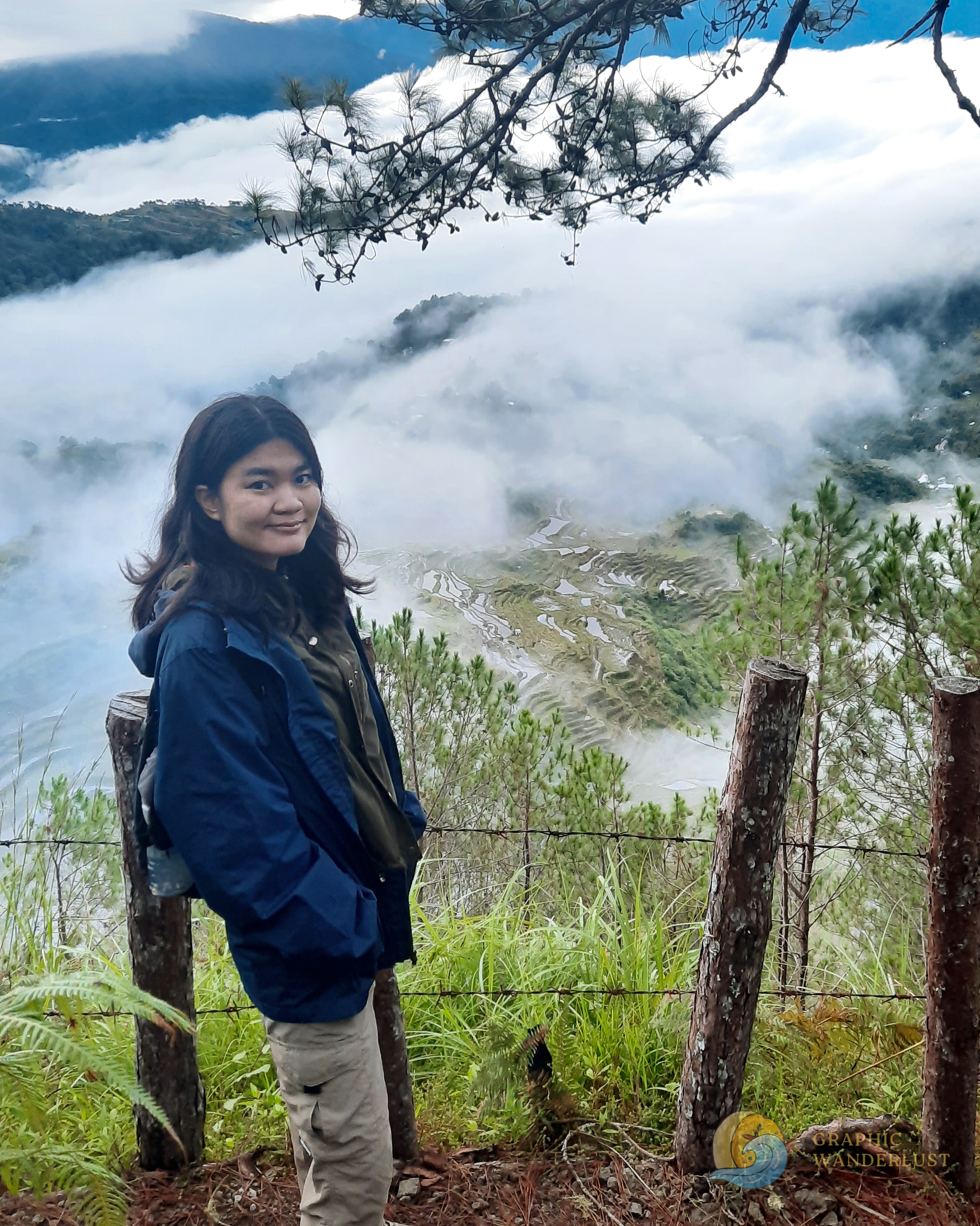
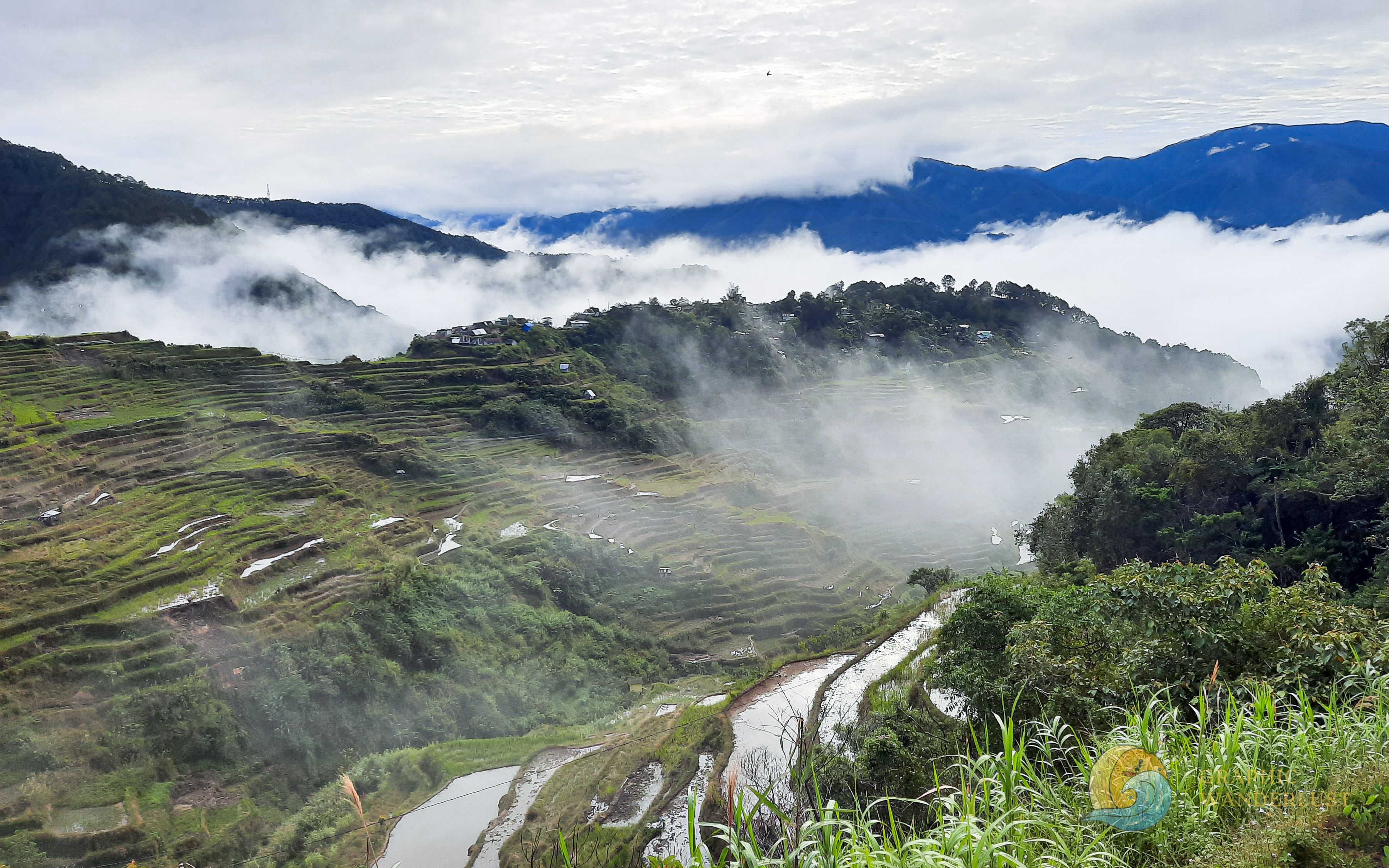
Just when I thought that wouldn’t be able to see a sea of clouds anymore from a mountain after failing to do so in Mt. Pulag last year, Mt. Kupapey presented me with a charming surprise with a view of a cluster of clouds formed right in front of me as I approached the edge of the summit. Unfortunately, due to the cloudy conditions at that time, we weren’t able to watch the anticipated sunrise but were presented instead with the clearing of the sea of clouds which gradually showed the majestic view of Maligcong Rice Terraces below us which was equally amazing.
Unlike the one found in Banaue, Maligcong Rice Terraces amazed me with its beauty with its more defined and dramatic features which showcase its apparent frequent use for livelihood by the locals. The surrounding clouds enveloping the peak of the mountains also added to the mystic feel of the scenery paired with the view of the neighborhood’s houses below which completed the scene as time passed by. Coincidentally and not far from us, our experience was further amplified with the cheering of a small crowd after a successful marriage proposal which added a romantic feel to our stay at Mt. Kupapey.


Traverse to Maligcong Rice Terraces
After more than an hour of watching and taking pictures with the rice terraces, sea of clouds and marker at Mt. Kupapey’s summit, we started our descent this time taking the traverse going to Maligcong Rice Terraces.
The first part of the trail started with the same path we took in our ascent to the summit, passing by the distinct grassland area which we were able to see clearer under daylight. The difference was when we reached the middle section of the trailway, we took a left turn instead of continuing straight forward. Soon after, we were once again back to another section of the pine tree forest with a well-marked trail which was enveloped with a scenic mist upon our arrival, before reaching the part that opened up to the rice terraces.
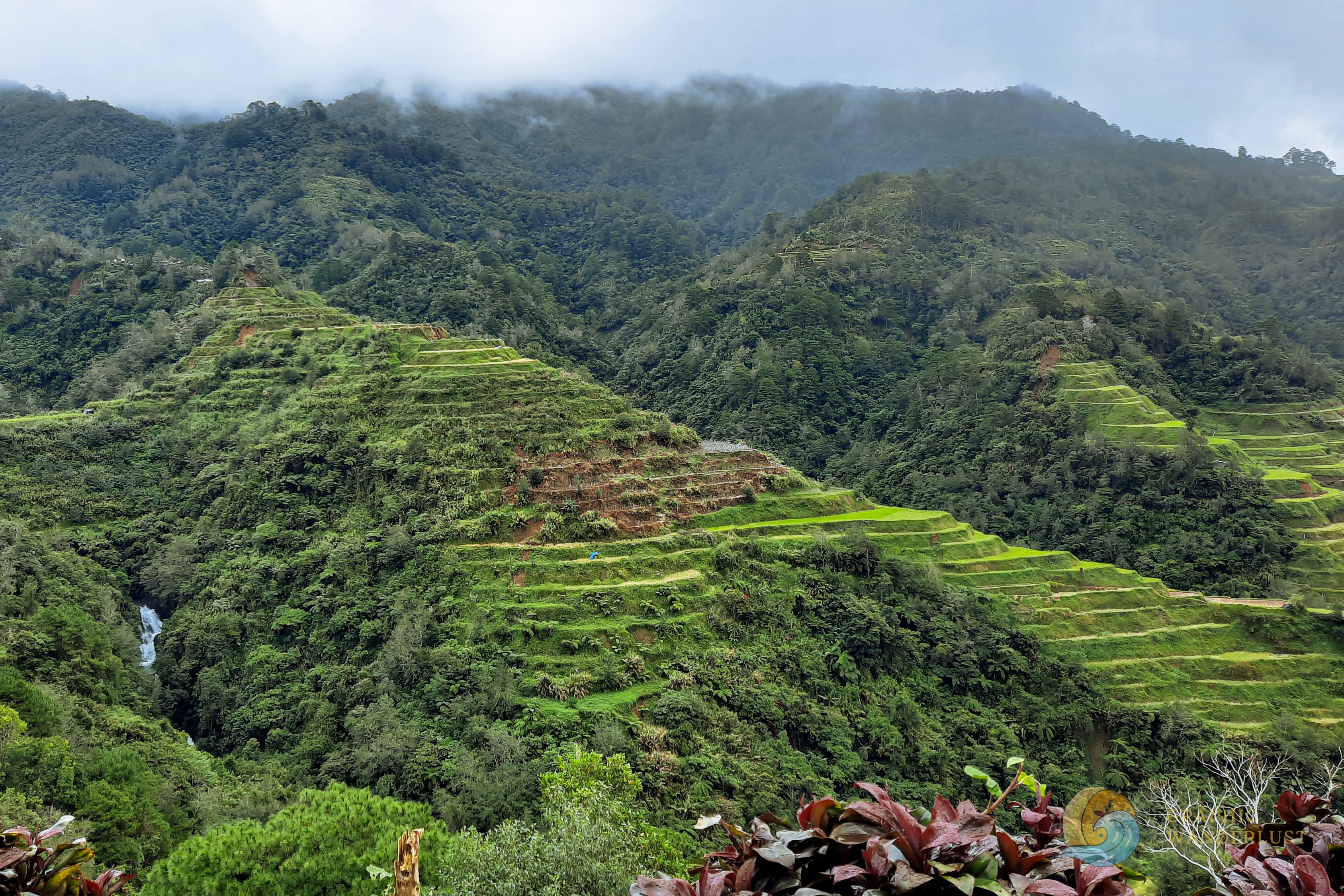
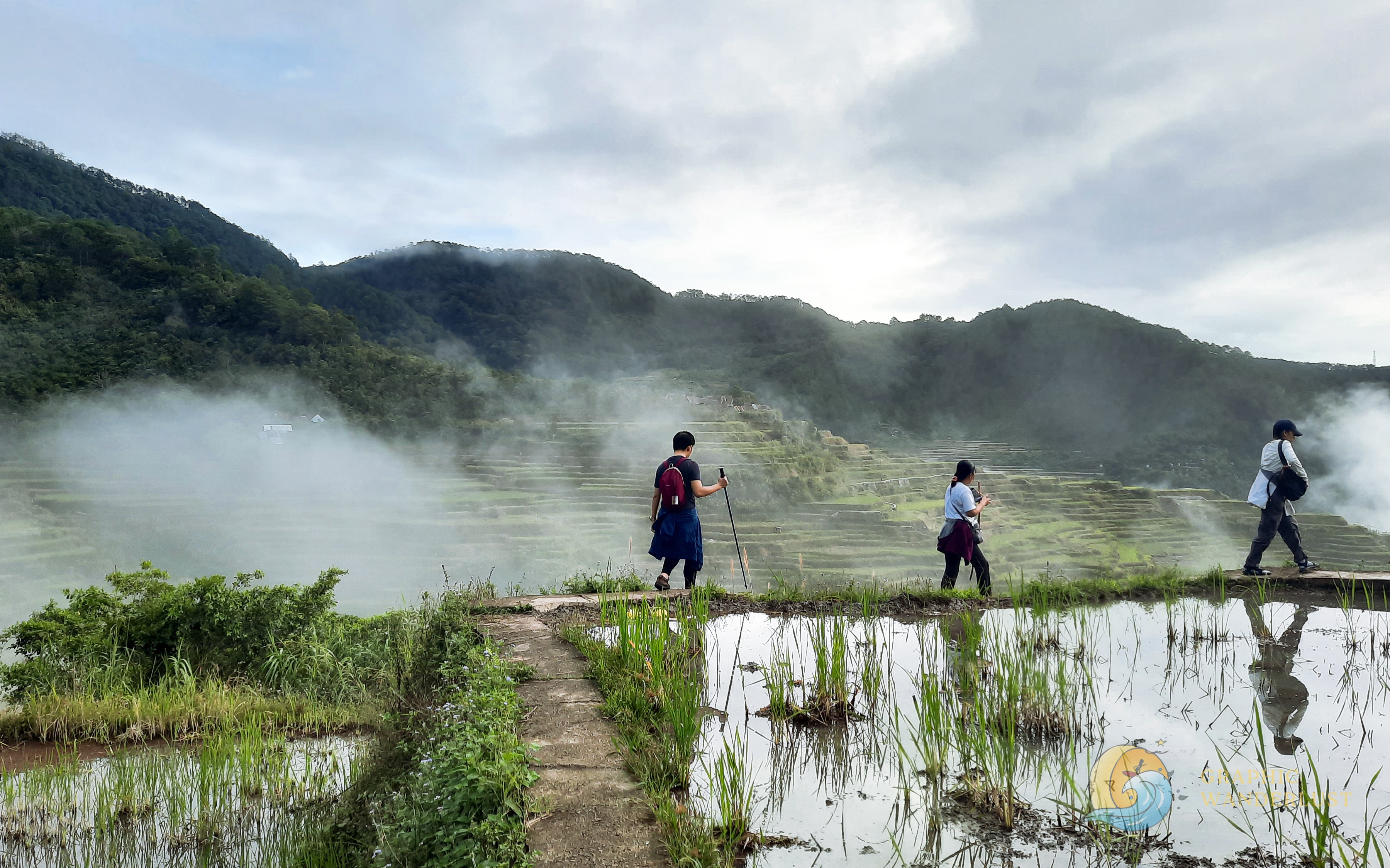
If there is one word to describe the view of Maligcong Rice Terraces from this part of the traverse, it would be breathtaking. The nearer distance of the terraced mountains from this vantage point makes one see and appreciate more the dramatic and more defined features of the place. The presence of passing clouds during our visit and the reflection of the sky on the nearby puddles also added to the mystic feel of the scene while the chance to walk along the narrow pathways at the edges of the terraces completed the thrilling experience.

After filling our eyes with the gorgeous view of the scenery and taking a handful of photos, we resumed our descent back to our jump-off point, reconnecting soon to the same path we took in our ascent and finally reaching our homestay at around 8AM.

Side Trip to Sagada and Halsema Highest Point
Less than 24 hours after we arrived, we hopped on our van again to depart from Maligcong and complete our Cordillera adventure in the remaining parts of our itinerary.
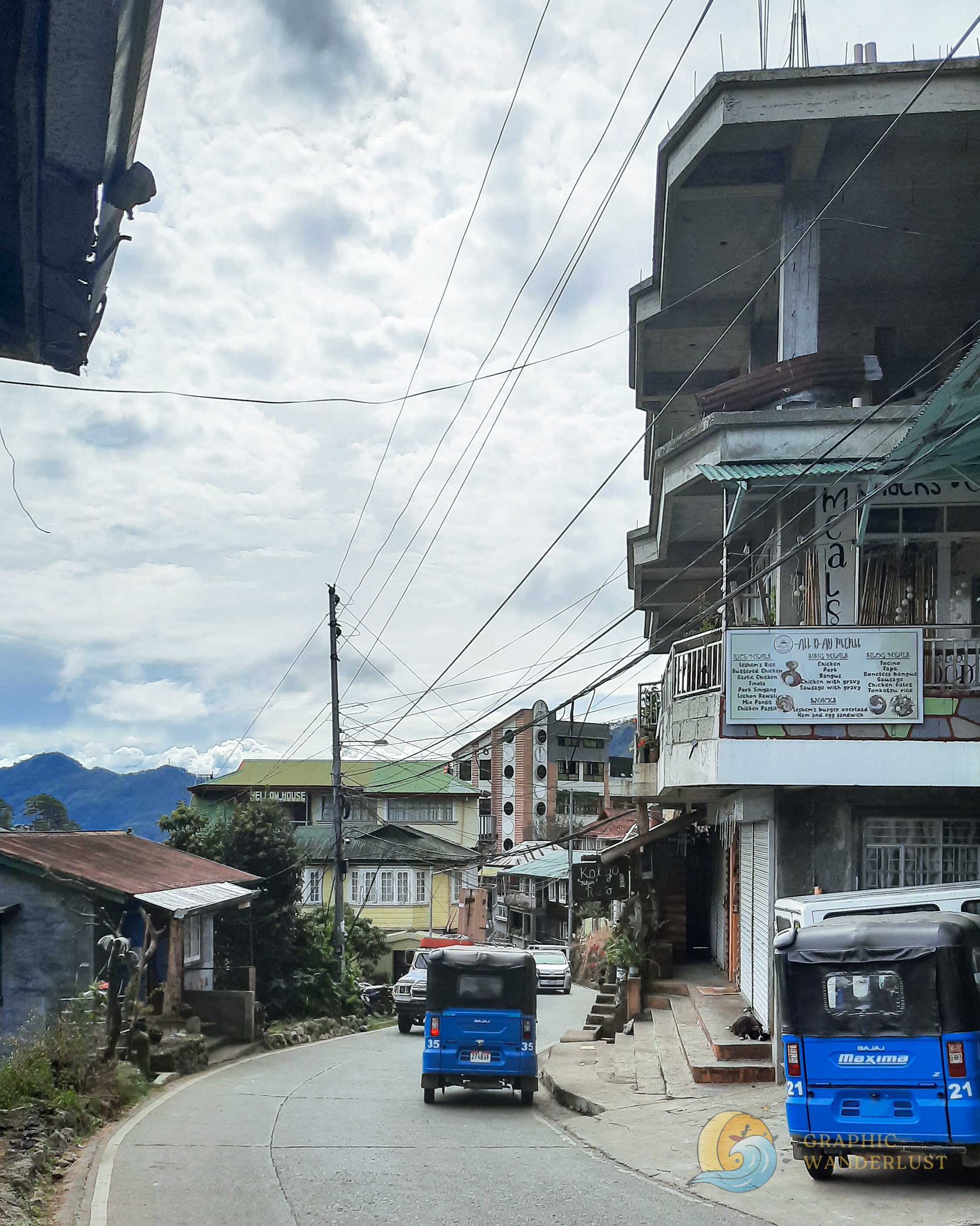
Located an hour away from our homestay, we took the drive to the nearby mountainous town of Sagada where almost non-stop zigzag roads welcomed us as we drove towards it.
At around 11AM, we finally reached our destination with Sagada Pottery as our first stop where some of my tourmates availed of the demonstration to witness a live pottery making for ₱100. For the others who opted not to join the demo including myself, we treated ourselves to the homemade yogurt (₱45) and wheat bread (₱50) sold at the place to fill our grumbling stomachs.


The next stop in our itinerary was St. Mary’s Church where I was able to get the chance to closely observe the unique character and culture of Sagada as a first-time visitor.

Contrary to most parts of the country, this place of worship is an Anglican church and not a Roman Catholic one which mostly dominates in the Philippines. The striking architecture of the building also differs from the common Catholic structures I am used to with its stone and wood construction paired with Gothic elements as seen in its pointed arches and stained glass rose windows. Its distinct altar made out of wood and stone also caught my attention which accurately reflects the rustic culture of Sagada.


The surrounding lush greenery of the church also made me aware of the town’s laid-back mountainous feel. The fresh and crisp air and simple design of buildings paired with a setting of lush mountains as a background completed the scene of Sagada; no wonder why the place has become a local-favorite destination which is a far cry from the tropical landscape that the country mostly offers. This was further reflected when we made a stop at Tam Tam Café at South Road where most of the town’s establishments are found, perched at the sides of the sloping street.
After a quick coffee break, we resumed the last leg of our trip with Halsema Highest Point in the municipality of Atok, Benguet as our second to the last stop.
Located 89 kilometers from our last destination, travel time to the place took us more than four hours to complete due to the dizzying winding roads and a stopover at Bauko, Mountain Province to grab late lunch. Honestly, I deem this part of our trip as the worst one because the route included a lot of zigzag roads that made me sick and nauseous. Fortunately, however, the latter didn’t worsen as we successfully reached our destination without me having to vomit.
Formerly hailed as the highest point in the Philippine highway system sitting at 2,255 MASL, Halsema Highway boasts an overlooking view of a part of Cordillera’s lush mountain range paired with a chilly temperature. The place is a usual pitstop for travelers coming from Sagada and Bontoc, Mountain Province and comes with a designated viewing deck for sightseeing. However, it was stripped of its title last 2019 with the completion of the Kiangan-Tinoc-Buguias Road in Tinoc, Ifugao which sits at a staggering 2,428 MASL.
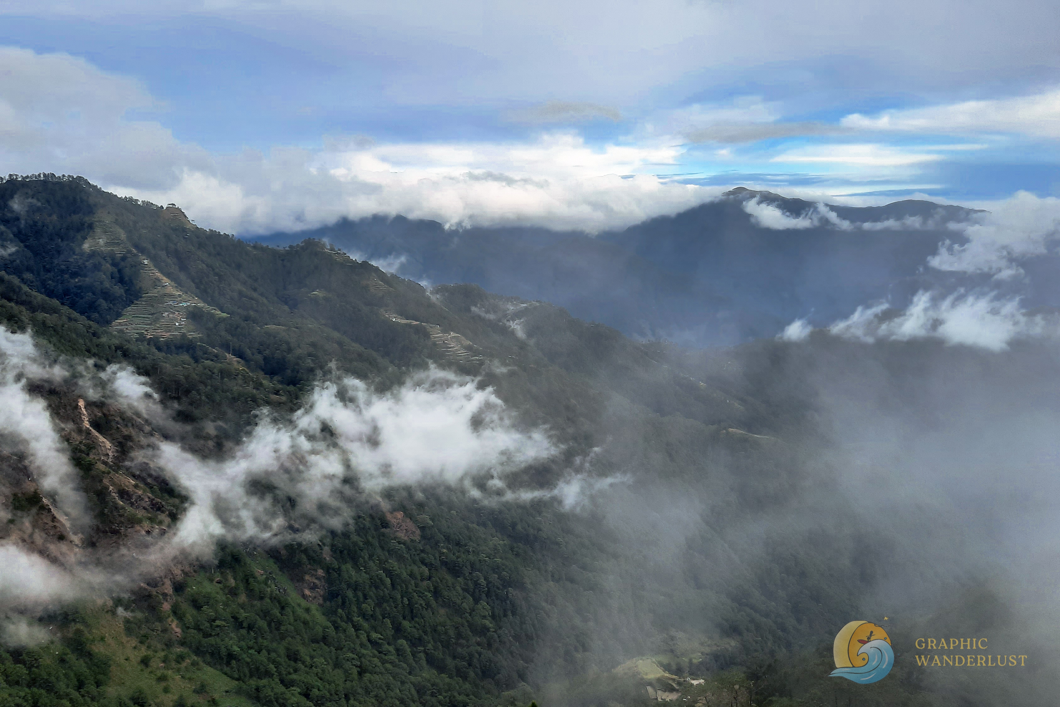
There’s really not much to do in the place aside from sightseeing and souvenir shopping but one could easily feel the high elevation of this vantage point with its chilly temperature whose coldness was difficult to beat with my two-layer clothing during our visit. Honestly, after five minutes of being in the place, I had to go back inside our van again since the cold was too much for me to handle.

Finally capping off our trip was our last stop in Baguio City, Benguet at a roadside souvenir shop where we bought a few items including the mandatory strawberry jam and coffee as proof that we have visited the Cordillera region. Soon after, we commenced our five-hour drive back home to Manila, arriving 40 minutes past midnight and ending our weekend excursion.
Tips for Hiking Mt. Kupapey and Mt. Fato
- Bring a hiking pole if you can. As reiterated, the first parts of Mt. Kupapey and Mt. Fato’s trails are steep and having a sturdy pole or stick is an advantage in navigating your way up to the summit if you’re not a seasoned hiker.
- One or two layers in the homestay and three layers at the summit. Despite Maligcong having milder temperatures when compared to Mt. Pulag, the neighborhood still experiences a drop in the thermometer, especially in the early mornings and evenings. This temperature further goes down when it rains or when it is windy, especially at the summit, so be prepared for an extra layer when you climb up.
- Ensure to bring a headlamp when climbing Mt. Fato in the afternoon. Although I managed to survive hiking in the dark using my phone’s flashlight, bringing a headlamp during your afternoon climb, especially during November and December, is still the best practice for a convenient climb. Do not always assume that your group will be back at the homestay before dark which was a mistake I made.
Reminiscing, it’s quite amazing to realize that the place that I’ve been postponing visiting for years due to my travel anxiety has significantly diminished after I’ve safely returned home from it. I suppose I instilled too much fear inside my head that the roads to the Cordillera region were unsafe, preventing me from discovering its beauty sooner. And now that I have experienced its irresistible charm, the desire to see and explore it more lights up like a flame in me that is waiting to grow. My return can be in a few months or in a few years but one thing is certain, the Cordillera offers a part of the Philippines that you wouldn’t experience elsewhere.
Ready to put Mt. Kupapey, Mt. Fato and Maligcong Rice Terraces on your Cordillera checklist? Share your thoughts below or questions you may have in mind about hiking them! 🤗
If you also find this post useful, you can support me in creating more travel and hiking guides in the future! Just tap on my Ko-fi or Buy Me a Coffee profile to get started or share this post with your friends or socials for free!
Read more mountain posts


Any thoughts?