Baguio City barely needs an introduction. With its nature parks, pine tree-brimming hillsides and, of course, it’s cool weather that differentiates it from the rest of the country, the City of Pines has become synonymous to a destination where Filipinos can escape the tropical heat, earning its name, the Summer Capital of the Philippines.
Personally, prior to this trip, I’ve already been to the place three times and have seen major tourist spots such as Session Road, Mines View Park, Baguio Botanical Garden, etc. Yet despite this frequency, this city still doesn’t fail to surprise me with every visit.
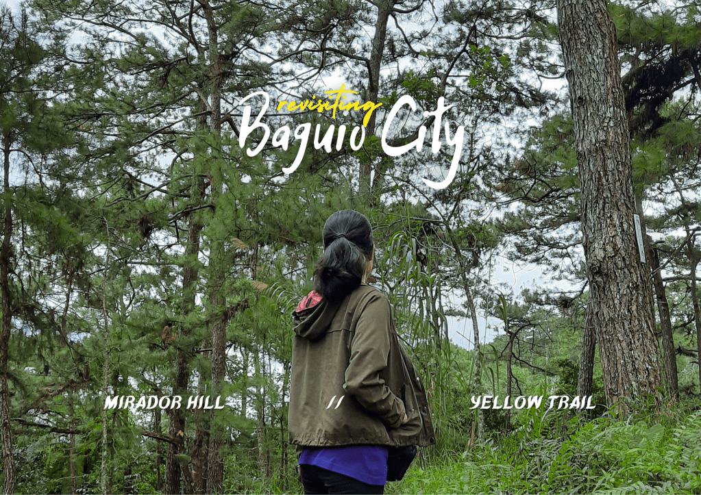
Originally planned as a trip to escape my monotonous Manila life and revisit some of my favorite spots in the city, my recent travel to Benguet took a different path upon discovering two new places in the City of Pines: Mirador Heritage and Eco Park and Camp John Hay’s Yellow Trail—the former recently opening to the public just last 2020 and the latter which I first encountered on Google Maps. Both destinations are located within the city and accessible via public transport, allowing me to create a not-so-usual yet convenient and familiar Baguio itinerary.
The initially-planned solo trip has also changed when a friend decided to join me, almost recreating our trip together in the place back in 2019 when we hiked Mount Yangbew and Mount Kalugong in La Trinidad.
DISCLAIMER: This post hasn’t been updated recently. I highly suggest checking the relevant entities for the updated price rates.
Table of Contents
- 2022 Travel Requirements
- How to Get to Baguio
- Mirador Heritage and Eco-Spirituality Park
- Camp John Hay Yellow Trail
2022 Travel Requirements
Despite the easing of travel restrictions both nationally and globally, entering Baguio City still requires submission of documents prior to arrival.
Leisure travelers are required to register and schedule a visit at Baguio VISITA, a portal website by the tourism office where visitors can find various travel information about the city. Registration is straightforward and requires inputting of personal and contact information, trip dates, hotel accommodation and transport details and uploading of proof of COVID-19 vaccination.

After completion of necessary information, travelers are also required to obtain a QTP code by contacting their chosen accredited accommodation who will approve the pending travel application and prompt the generation of QR code.
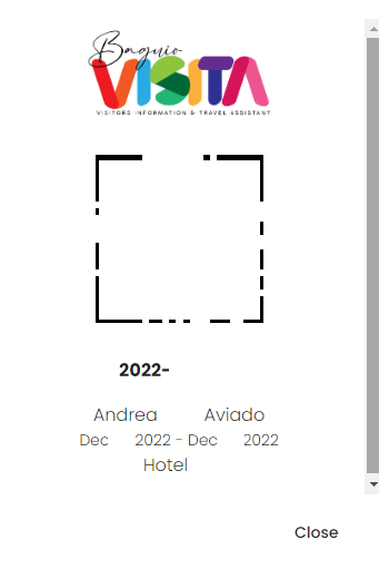
During our trip, we haven’t experienced to have anyone check or scan our obtained QTP codes, hence, probably why other people are saying that it is not required anymore upon entry to Baguio. But to be sure and upon verification with the city tourism office, it is still best to register in Baguio VISITA prior to your scheduled visit for a hassle-free trip.
How to Get to Baguio
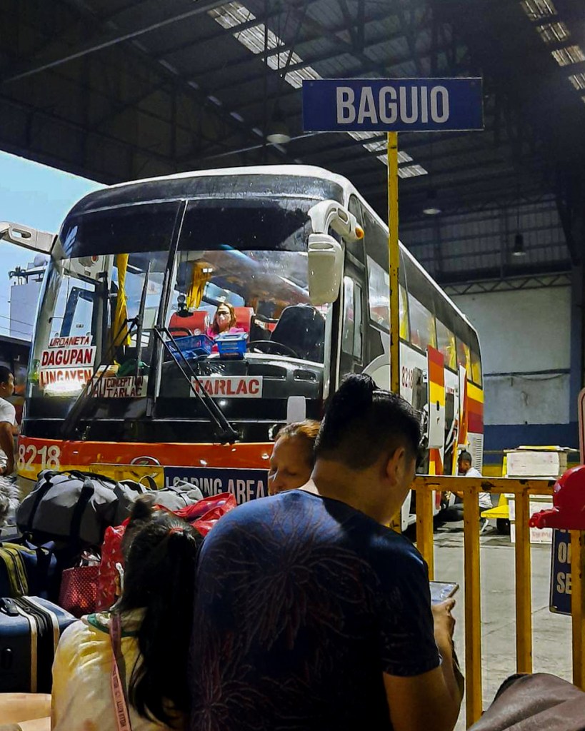
Contrary to the previous years, there have been a lot of additional options when traveling up to Baguio.
The traditional ways are either riding a regular air-conditioned bus from Caloocan, Sampaloc, Cubao, Pasay or Parañaque Integrated Terminal Exchange (PITX) if coming from Manila, or driving a private vehicle and taking the Tarlac-Pangasinan Expressway (TPLEX).
For added luxury and comfort there are also premium or executive buses that service the Manila-Baguio route from Victory Liner and JoyBus. These type of coaches have larger seats and leg space and come with an onboard toilet, complementary snacks, bus attendant and sometimes an accompanying tablet at the seat.
Regular air-conditioned bus fares range from ₱616-₱695* while premium or executive buses range from ₱895-₱999*. Travel time is around five to six hours for regular buses and around four hours for premium/executive buses and private vehicles.
*Peak season rate.
Book your Manila to Baguio transportation here!
Mirador Heritage and Eco Spirituality Park
A newcomer to the Baguio tourist scene, Mirador Heritage & Eco-Spirituality Park, or simply Mirador, has already been part of the city as early as the late 19th century.
Due to its strategic high location, the area was and is still is currently being used as a meteorological observatory to study different weather conditions and seismic activities. It also serves as a retreat place of Jesuits during vacations and functions as a conference area for businessmen, journalists, students and many others.
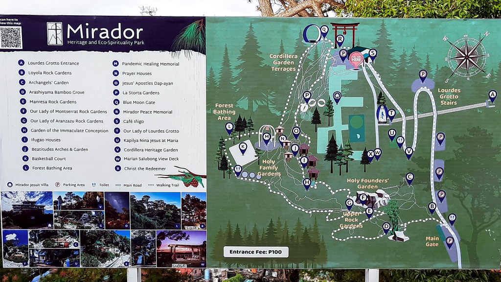
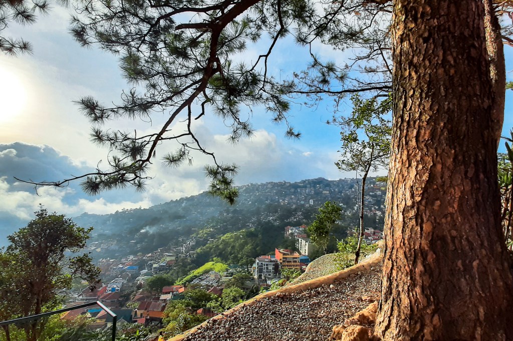
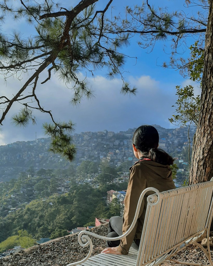
It is easy to understand why the Jesuits chose Mirador Hill as their retreat sanctuary. Despite being developed today to accommodate tourists, the view of the surrounding area will give you a glimpse of what the earlier priests may have probably seen when they first went up to Mirador.
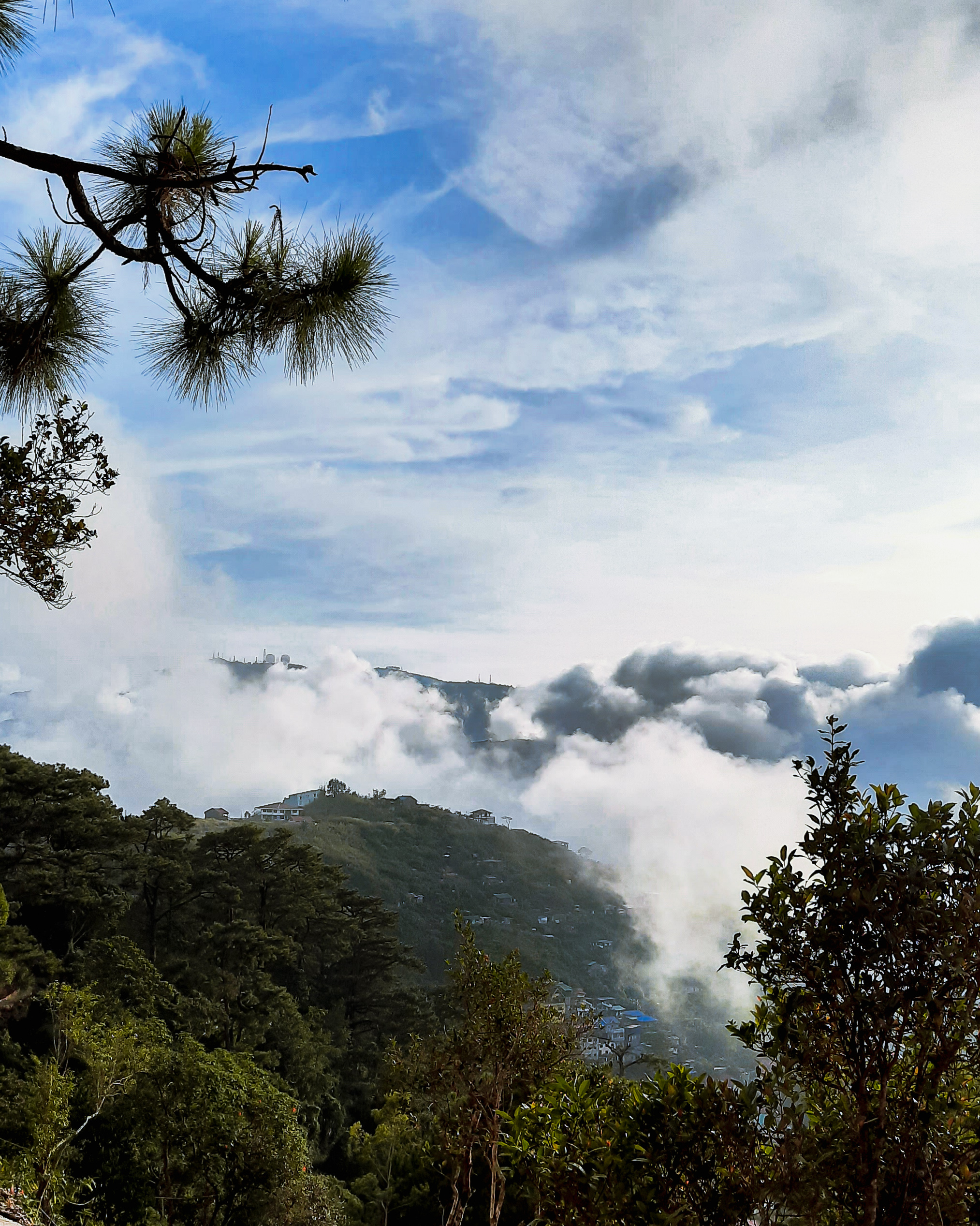
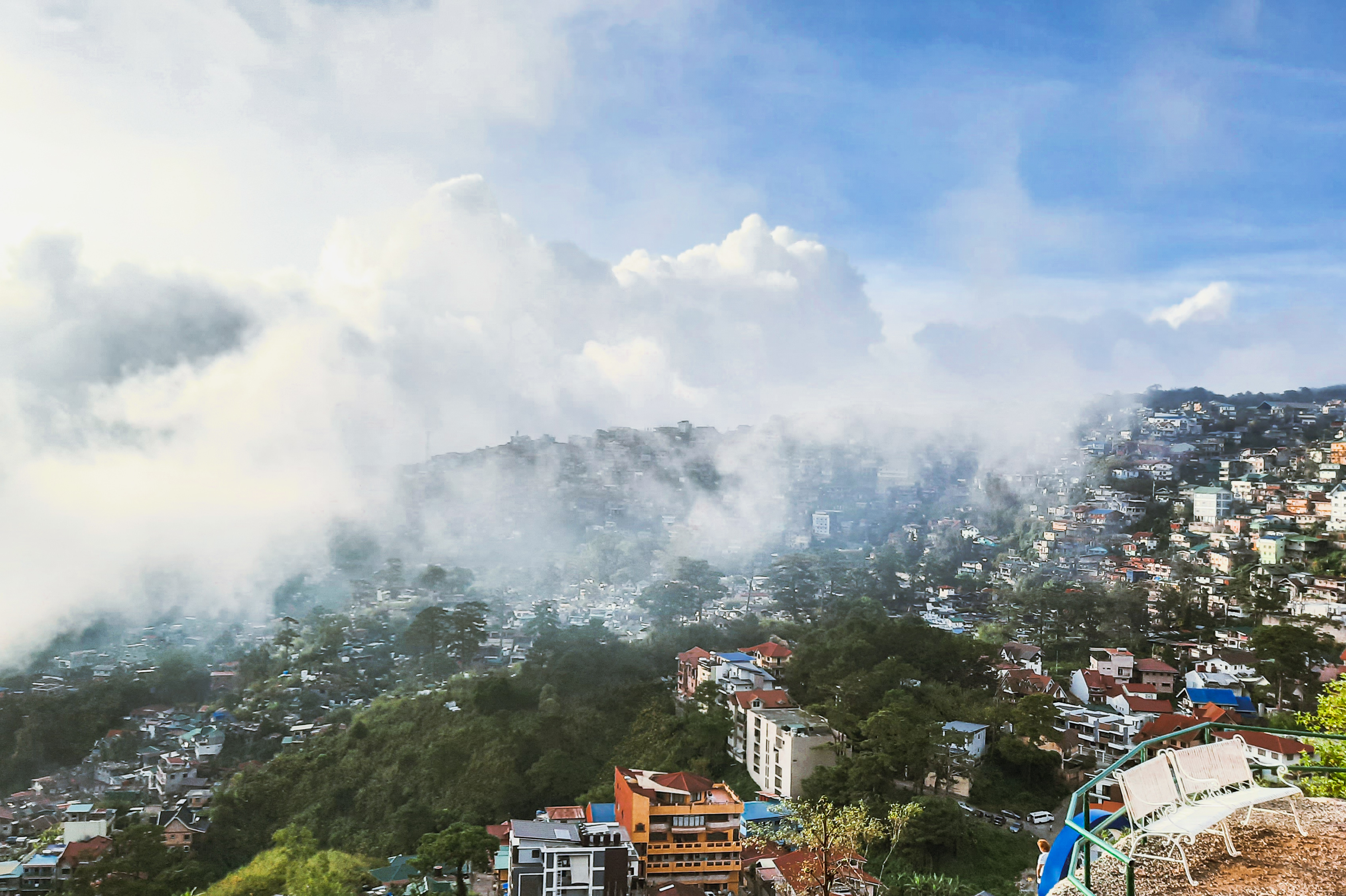
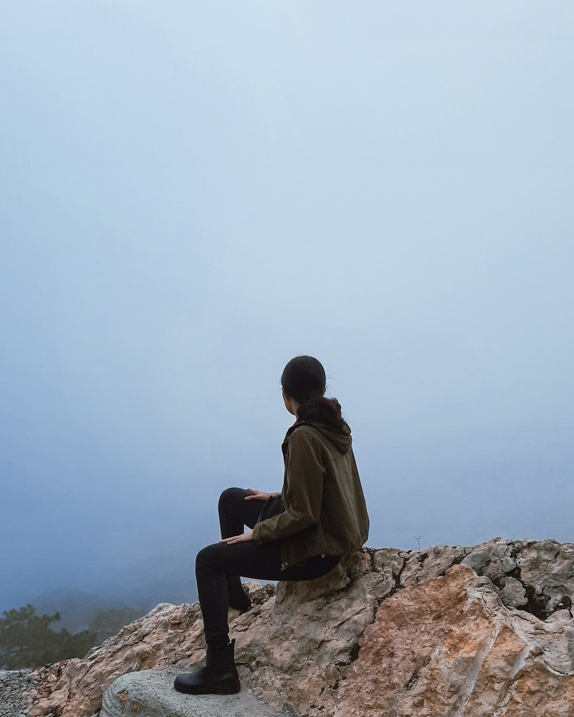
During our visit and after several steps from the entrance gate of the so-called Cordillera Garden Terraces, we were instantly welcomed by the afternoon sun shining brightly above a thick set of clouds—an actual heavenly scene that made me think for a quick second that maybe I’m already in the afterlife—and a view of Baguio hillside that overlooks its lower parts to our right. To our left was another view of a nearby hill being enveloped by the sea of clouds and Mount Cabuyao overlooking behind it with its distinctive Mickey Mouse dish satellites.
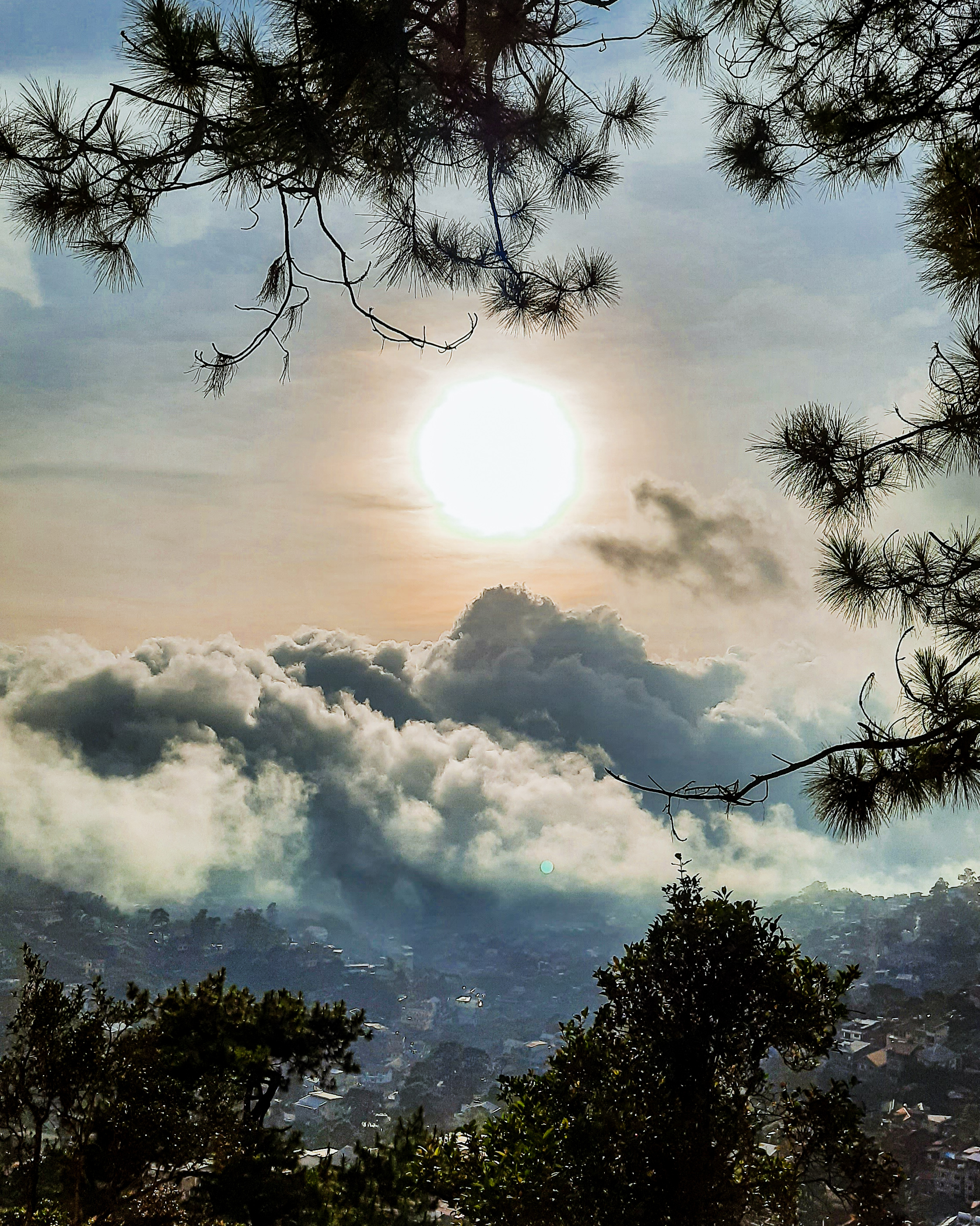
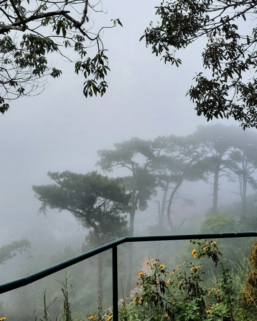
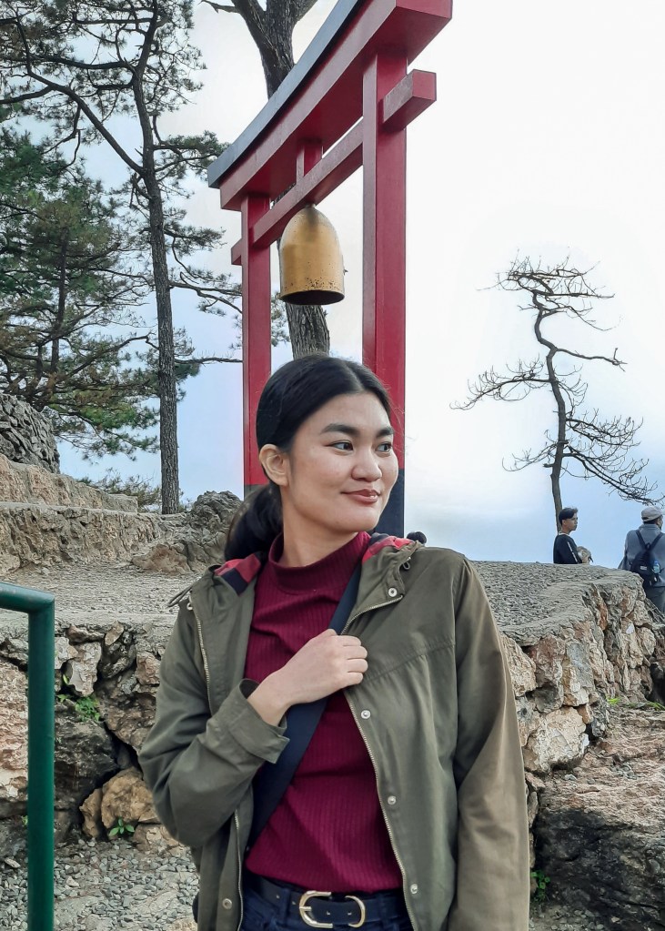
Along the way, there are a handful of benches and prayer stops available for visitors who want to reflect and pray or simply to take in the scene. There are also several photo op spots in the area with the Instagram-famous Mirador Peace Memorial’s torii gate taking centerstage for its Shinto shrine-inspired scenery. Beyond it is a background that varies depending on the current weather condition that offers an overlooking view of Baguio City during a clear day or a scenic foggy scene during colder ones.
Aside from the picturesque views at the Cordillera Garden Terraces, there are other spots in the place that are also worth the visit such as the Upper Rock, Holy Founders and Holy Family Gardens, the Forest Bathing Area and, of course, the famous Lourdes Grotto stairs.
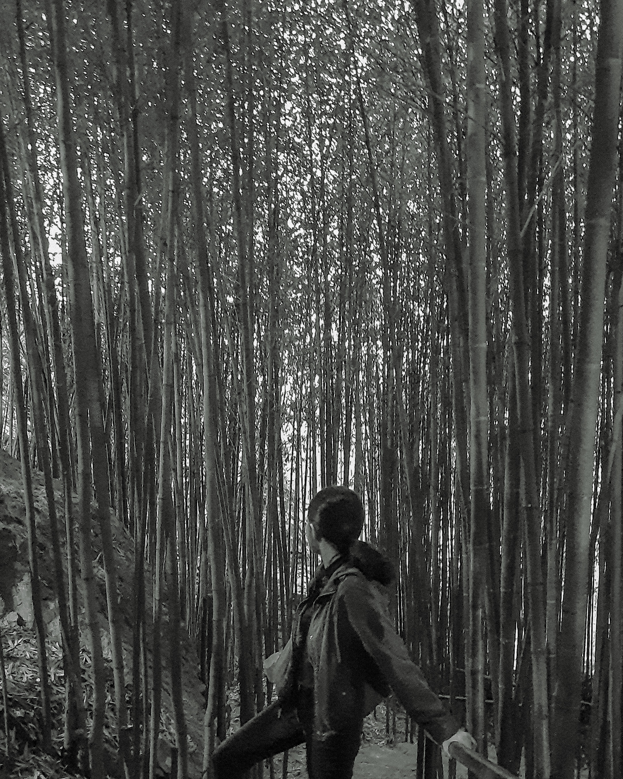
We weren’t able to visit the aforementioned, with the exception of the latter which we were able to pass by as we made our way to the exit, but managed to squeeze a few minutes at the popular Arashiyama Bamboo Grove.
Reminiscent of its inspiration in Kyoto, Japan, the bamboo grove in Mirador is like a mini version of it flanked by big rocks at the side of the pathway due to its hillside location. There’s really not much to do in the spot but if you want to complete your Japanese-inspired photo ops, it is best to drop by before sunset as the tall bamboos can restrict the entry of light.

Access to all the spots in the place is covered, except for the Lourdes Grotto stairs which is free, by the ₱100 entrance fee that can paid at the ticket booth near Cafe Iñigo.
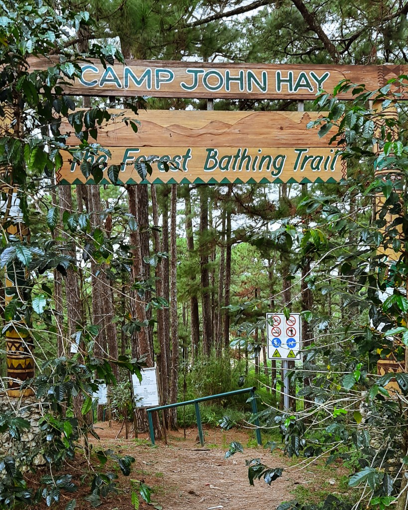
Camp John Hay Yellow Trail
A mainstay in the list of must-see tourist spots in Baguio, Camp John Hay has already cemented its name as a place that provides a quick nature escapade to both locals and tourists weary of the busy city life.
Known for its towering pine trees, picnic spots, amusement activities and distinct Americana feel, this former US military recreational facility also has natural hidden gems that are not known to many.
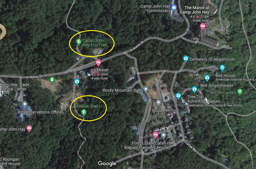
An accidental discovery when I was planning this trip, I first learned of Camp John Hay’s hiking trails while browsing through Google Maps. Located along the sidelines of the more popular Scout Hill and Le Monet Hotel, the Eco-Trail and Yellow Trail (or Forest Bathing Trail) are two of the beginner-friendly hiking spots found in the area. Both are accessible upon entry in Camp John Hay and requires no entrance fees for those who want to explore it.
To satisfy our nature adventure craving, we decided to take the longer Yellow Trail. Despite being our first time to visit the place, reaching the start of this hiking spot was easy since security guards will direct you to it after registration and asking your destination within the camp.
There are several starting points to reach Yellow Trail. The popular one is the path located near Filling Station and Camp John Hay’s Horseback Riding which is more convenient if you’re coming from the city center. There’s also another one located at Scout Hill near the picnic area and another beside the Butterfly Sanctuary which we took.
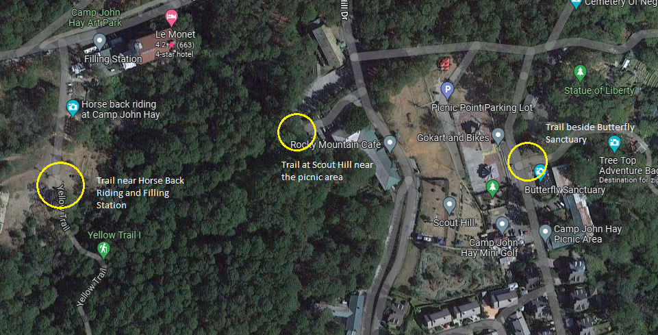
Regardless of which starting point you choose, you’ll end up at the other side of the trail since it is a loop. But if you want an easier hike, I suggest the starting point beside Butterfly Sanctuary because the trail will be descending since it starts from the top.
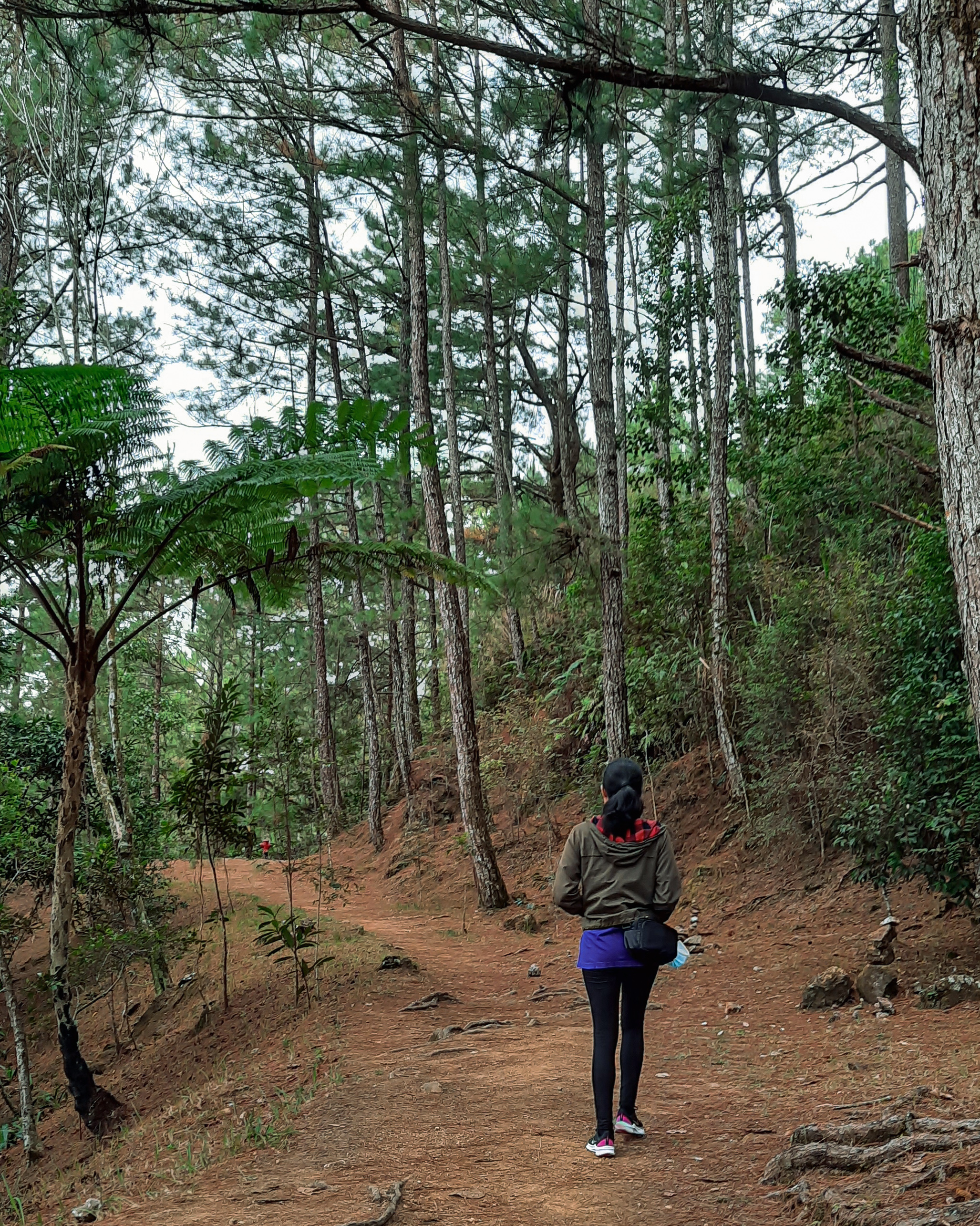
Our hike started in the part of the forest where the trail was filled with usual trees and tall grass flanking the path. As we walked further, the sight of pine trees grew larger in number and the foliage beside the trail were added with ferns and bushes. The path itself started narrow but becomes wider when you get close to the main trail. There are also several junctions along the way which can easily be resolved by either consulting Google Maps for directions (yes, there’s phone reception in the area) or looking for signs posted in trees.
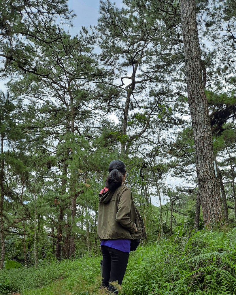
The main part of Yellow Trail is composed of never-ending views of pine trees. At the middle part, you’ll get a glimpse of an overlooking view of a mountainside signaling that you are at a high point. Interestingly, there are also fire hydrants and water pipes along the way and signages that you are in a United States of America property. As it turns out, there’s a part of the trail that overlaps with the area of the nearby US Ambassador residence.
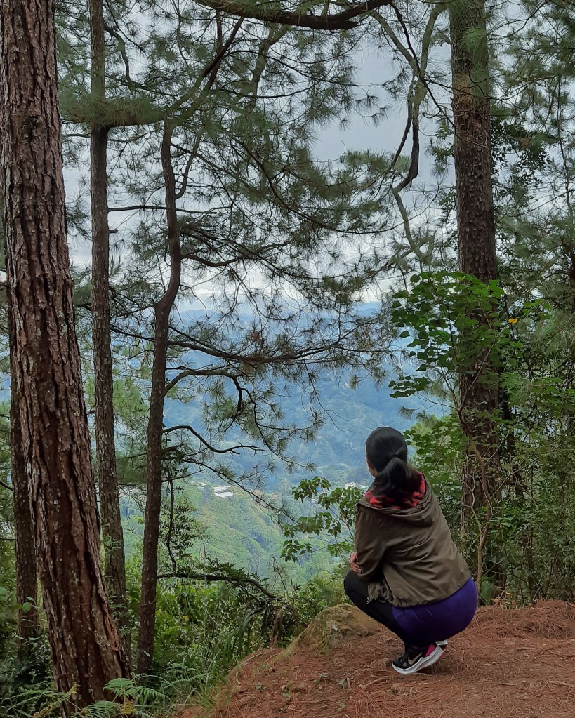
Stopping in between to appreciate this scenic view along the trail 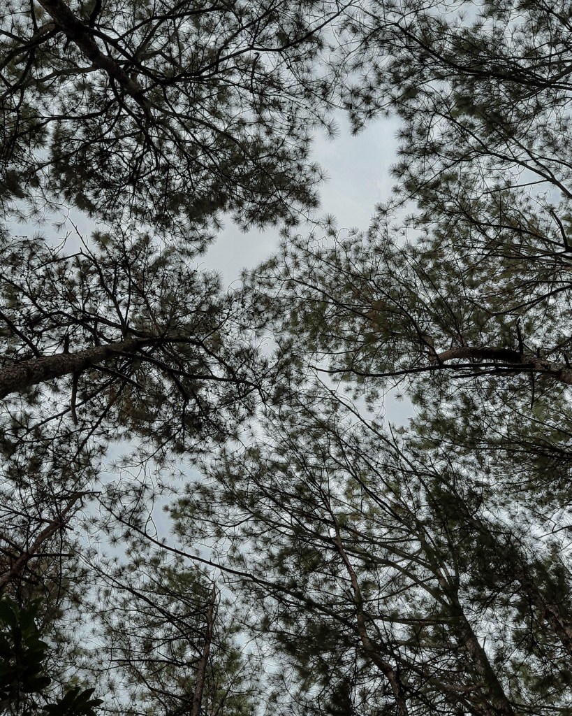
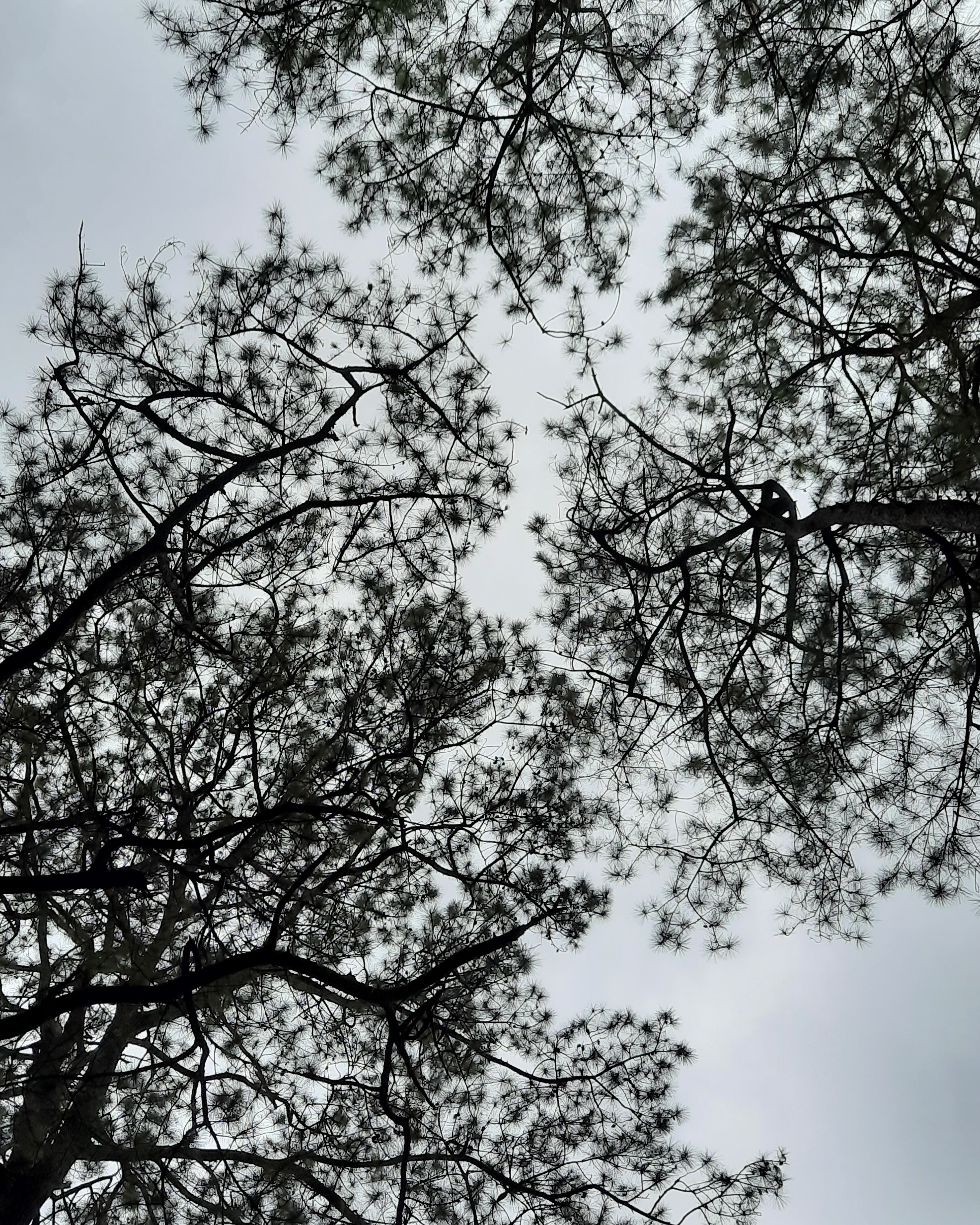
View of the canopy of pine trees towering over the trail in Yellow Trail 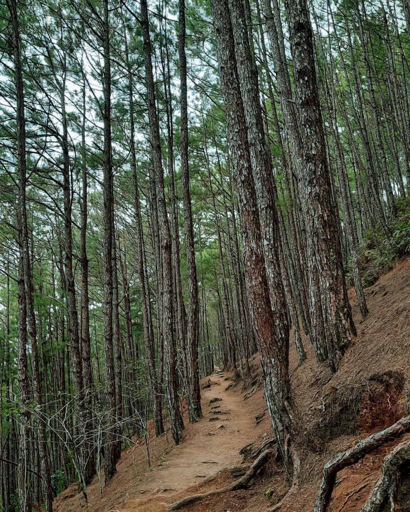
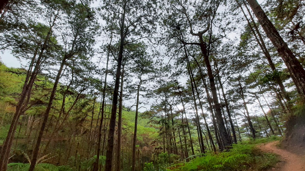
Tall pine trees flanking the path of the Yellow Trail 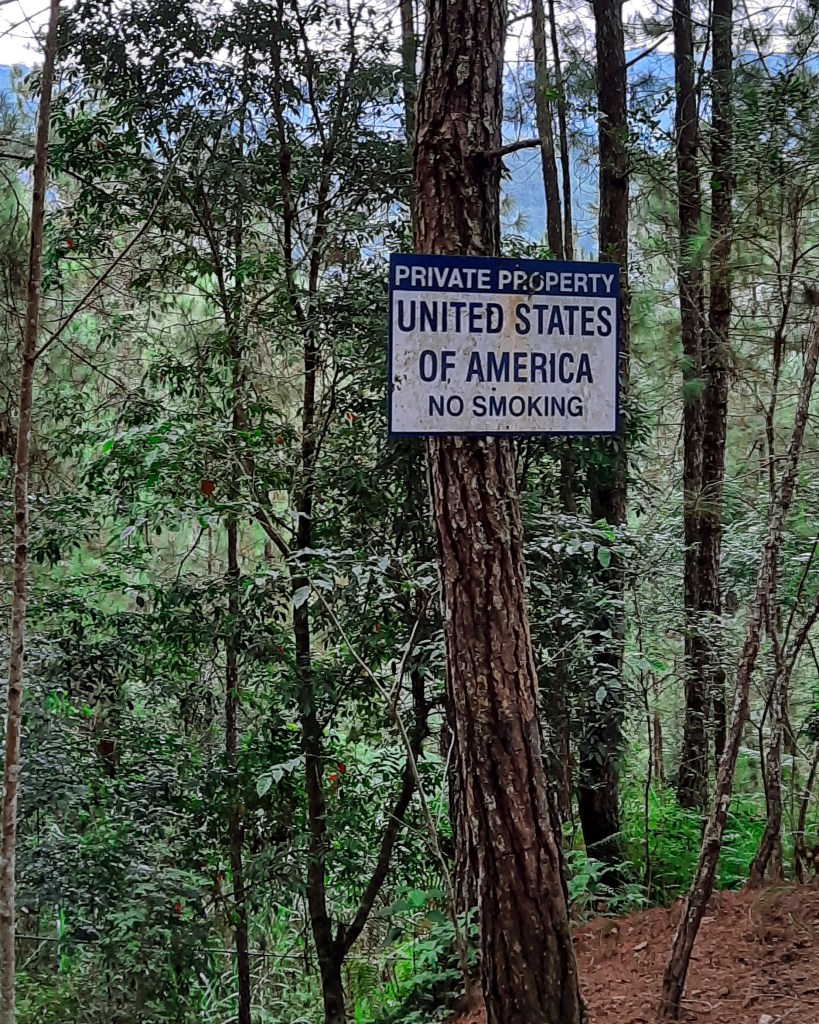
Signage along the Yellow Trail saying that the property is owned by the United States of America 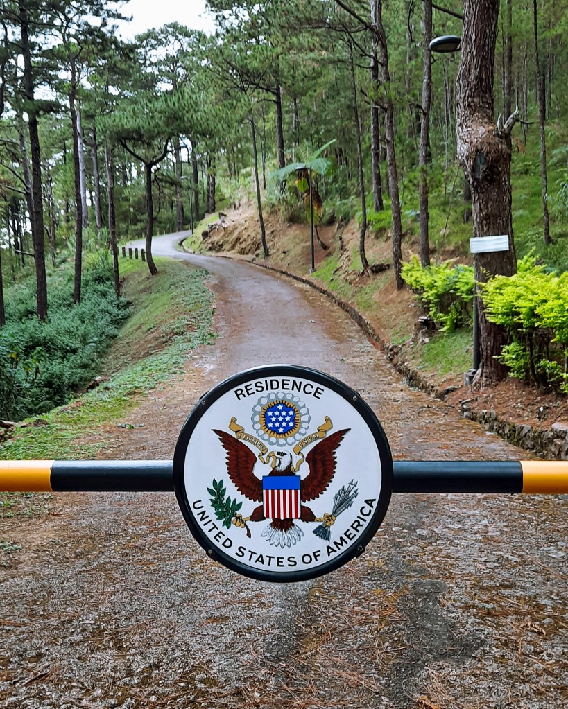
Signage along the trail in Yellow Trail indicating the path going to the residence of the US ambassador to the Philippines
Towards the last leg of the trail, there are also bamboo hanging furnishings that can be found at the side of it. Frankly, we don’t have an idea what these signify but as we walked a little more behind our first encounter of it, we saw a makeshift bench made out of a log and took a rest in it.
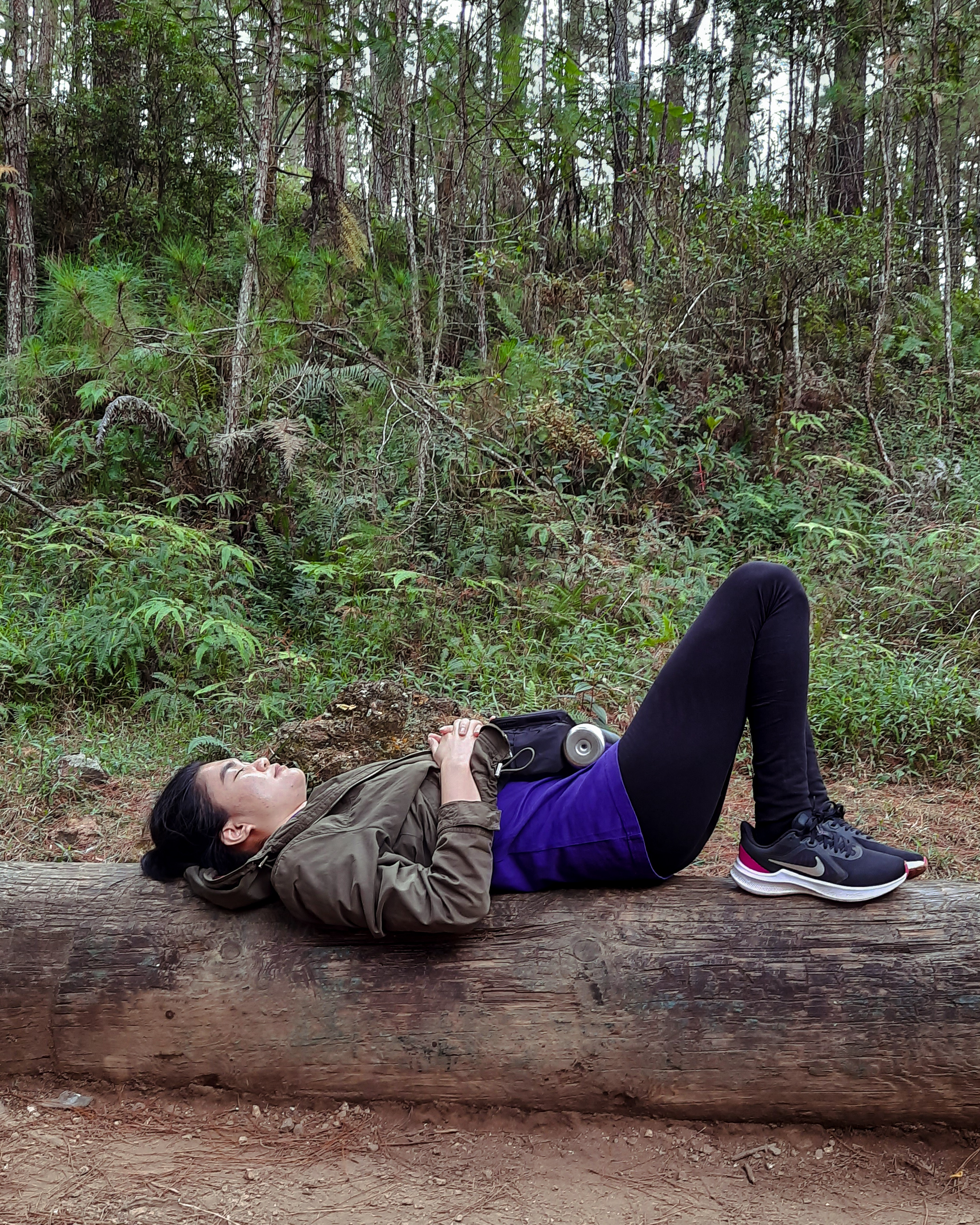
It was during this time when I realized the essence of the trail’s Forest Bathing name. Laying down, the only view you’ll see is the canopy of pine trees interlocking with each other’s leaves and feeling the sun’s heat hitting your face despite its invisible presence. The silence of the place was also relaxing that, despite our already more than an hour hike, I was instantly recharged after 20 minutes of resting at it.
The last part of the trail is probably my favorite because of the more densely-packed towering pine trees that creates an ambiance of being deep within the woods. The path also started to look rugged and similar to the usual trails found in mountains. The sound of passing cars below us was also a relief and gave us an idea that we are near the end and that we are probably on top of one of those hillsides at the side of the main road. And when we saw the back of Le Monet Hotel overlooking ahead of us, we knew that a couple of steps more, we’re going to reach the end of the trail.
Eventually, we found ourselves standing underneath the same arch we’ve seen at the beginning of the trail but this time in the other point at Scout Hill near the picnic area.
It’s amusing to think that, despite of how many times I’ve been to Baguio, there’s always something new to discover, and Mirador Hill and Camp John Hay’s Yellow Trail are proofs that the City of Pines is more than just one-time-visit destination. Have you already been to these places too? How was your experience? Share yours in the comments below!
If you also find this post useful, you can support me in creating more travel and hiking guides in the future! Just tap on my Ko-fi or Buy Me a Coffee profile to get started or share this post with your friends or socials for free!
Read More hiking posts


Any thoughts?